
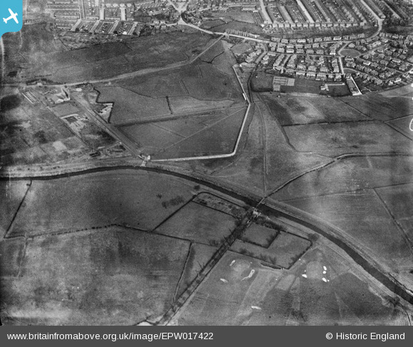
epw017422 ENGLAND (1927). Jackson's Bridge and environs, Chorlton-cum-Hardy, 1927
© Copyright OpenStreetMap contributors and licensed by the OpenStreetMap Foundation. 2024. Cartography is licensed as CC BY-SA.
Details
| Title | [EPW017422] Jackson's Bridge and environs, Chorlton-cum-Hardy, 1927 |
| Reference | EPW017422 |
| Date | 8-March-1927 |
| Link | |
| Place name | CHORLTON-CUM-HARDY |
| Parish | |
| District | |
| Country | ENGLAND |
| Easting / Northing | 380995, 392814 |
| Longitude / Latitude | -2.2860782187715, 53.4315107557 |
| National Grid Reference | SJ810928 |
Pins
 clarke.k11 |
Wednesday 10th of January 2024 09:48:56 PM | |
ptopping |
Tuesday 7th of April 2020 01:48:28 PM | |
It pumped water from the Mersey, to the aqueducts, one of which can still be seen along the side of the river. The base of the Pump House is visible by the path. |
M Taylor |
Wednesday 3rd of June 2020 11:18:34 PM |
John Ellis |
Thursday 23rd of October 2014 03:27:51 PM | |
John Ellis |
Thursday 23rd of October 2014 03:27:15 PM | |
John Ellis |
Thursday 23rd of October 2014 03:26:13 PM | |
John Ellis |
Thursday 23rd of October 2014 03:25:28 PM | |
John Ellis |
Thursday 23rd of October 2014 03:22:52 PM | |
John Ellis |
Thursday 23rd of October 2014 03:22:17 PM | |
John Ellis |
Thursday 23rd of October 2014 03:21:23 PM | |
John Ellis |
Thursday 23rd of October 2014 03:01:30 PM | |
Adam davison home |
Thursday 25th of April 2013 11:29:43 AM | |
John Ellis |
Friday 26th of October 2012 05:49:27 PM | |
John Ellis |
Tuesday 10th of July 2012 06:43:32 PM | |
John Ellis |
Tuesday 10th of July 2012 06:39:44 PM | |
John Ellis |
Tuesday 10th of July 2012 06:34:09 PM | |
John Ellis |
Tuesday 10th of July 2012 06:33:19 PM | |
John Ellis |
Tuesday 10th of July 2012 06:32:00 PM | |
John Ellis |
Tuesday 10th of July 2012 06:13:47 PM | |
John Ellis |
Tuesday 10th of July 2012 06:13:19 PM | |
John Ellis |
Tuesday 10th of July 2012 06:11:40 PM | |
John Ellis |
Tuesday 10th of July 2012 06:04:15 PM |


