
epw017408 ENGLAND (1927). Wythenshawe Park, Baguley, 1927
© Copyright OpenStreetMap contributors and licensed by the OpenStreetMap Foundation. 2024. Cartography is licensed as CC BY-SA.
Nearby Images (4)
EPW017408

EPW036811

EPW036816

EPW036815

Details
| Title | [EPW017408] Wythenshawe Park, Baguley, 1927 |
| Reference | EPW017408 |
| Date | 8-March-1927 |
| Link | |
| Place name | BAGULEY |
| Parish | |
| District | |
| Country | ENGLAND |
| Easting / Northing | 381639, 389760 |
| Longitude / Latitude | -2.2762063940259, 53.404079702949 |
| National Grid Reference | SJ816898 |
Pins
 John Ellis |
Tuesday 14th of January 2014 03:52:51 PM | |
John Ellis |
Friday 26th of October 2012 09:40:58 PM | |
John Ellis |
Friday 26th of October 2012 09:37:05 PM | |
John Ellis |
Friday 26th of October 2012 09:36:22 PM | |
John Ellis |
Friday 26th of October 2012 09:34:39 PM | |
John Ellis |
Friday 26th of October 2012 09:33:31 PM | |
John Ellis |
Friday 26th of October 2012 09:32:53 PM | |
John Ellis |
Friday 26th of October 2012 09:31:52 PM | |
John Ellis |
Friday 26th of October 2012 09:30:16 PM | |
John Ellis |
Friday 26th of October 2012 09:29:11 PM | |
John Ellis |
Friday 26th of October 2012 09:28:37 PM | |
John Ellis |
Friday 26th of October 2012 09:27:45 PM | |
John Ellis |
Friday 26th of October 2012 09:25:14 PM | |
John Ellis |
Tuesday 7th of August 2012 05:07:03 PM | |
John Ellis |
Monday 2nd of July 2012 09:55:44 PM | |
John Ellis |
Monday 2nd of July 2012 09:54:07 PM | |
John Ellis |
Sunday 1st of July 2012 03:58:43 PM | |
John Ellis |
Sunday 1st of July 2012 03:43:32 PM | |
John Ellis |
Sunday 1st of July 2012 03:40:51 PM | |
John Ellis |
Sunday 1st of July 2012 11:46:59 AM | |
John Ellis |
Sunday 1st of July 2012 11:44:32 AM | |
John Ellis |
Sunday 1st of July 2012 11:43:49 AM | |
John Ellis |
Sunday 1st of July 2012 11:42:27 AM | |
John Ellis |
Sunday 1st of July 2012 11:42:03 AM | |
John Ellis |
Sunday 1st of July 2012 11:41:27 AM | |
John Ellis |
Sunday 1st of July 2012 11:40:16 AM | |
John Ellis |
Sunday 1st of July 2012 11:39:29 AM | |
John Ellis |
Sunday 1st of July 2012 11:36:25 AM | |
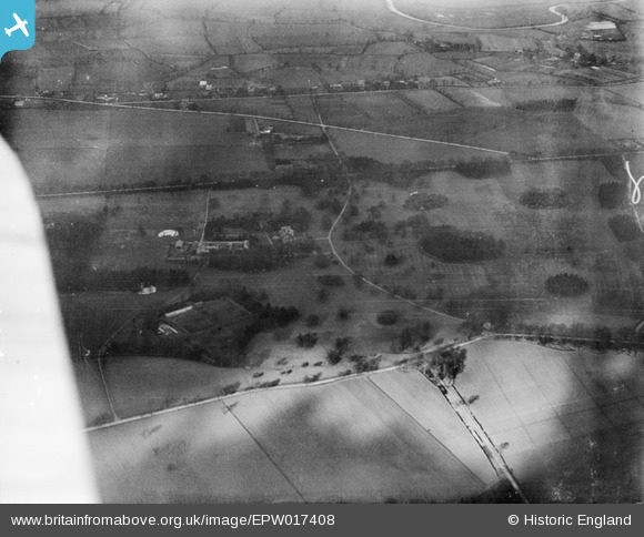
This half-timbered historic house was built around 1540 by Robert Tatton of Chester, and remained the home of the Tatton family for almost four centuries. A year before this picture was taken, his successor, another Robert Tatton, sold the extensive estate to Manchester Corporation for overspill housing, so this series of photographs show the area on the eve of an era of unprecedented change, which at this point had not quite begun. |
John Ellis |
Tuesday 7th of August 2012 04:46:34 PM |
John Ellis |
Sunday 1st of July 2012 11:35:46 AM | |
John Ellis |
Sunday 1st of July 2012 11:32:10 AM | |
John Ellis |
Sunday 1st of July 2012 11:30:11 AM | |
John Ellis |
Sunday 1st of July 2012 11:29:36 AM |
User Comment Contributions
Wythenshawe Park and Hall are historically in Northenden, not Baguley. |
John Ellis |
Sunday 1st of July 2012 12:06:22 PM |
Wythenshawe Park and Hall are historically in Northenden, not Baguley. |
John Ellis |
Sunday 1st of July 2012 11:28:51 AM |


