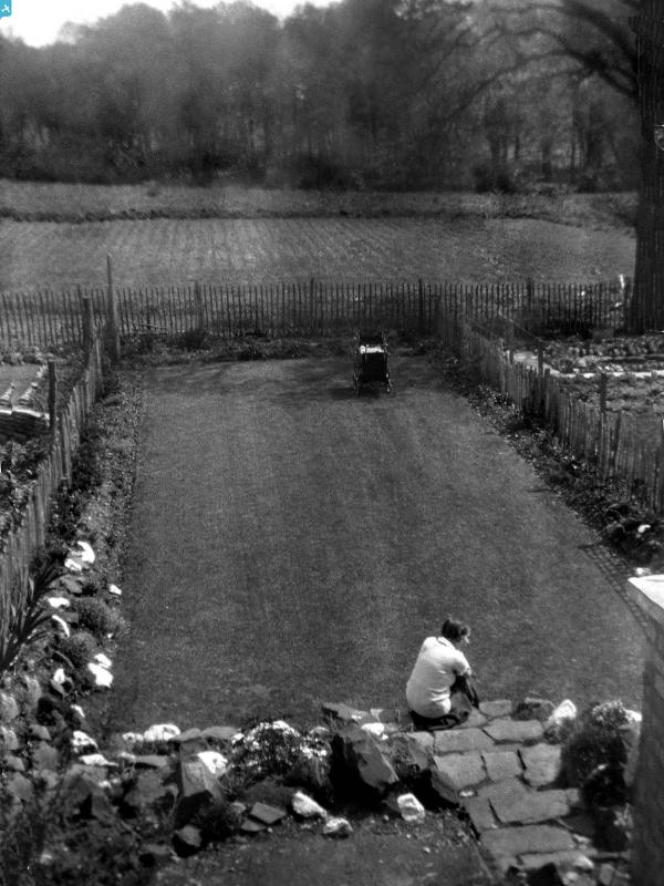
epw017046 ENGLAND (1926). View of Shirley Road and area, Acock's Green, from the south, 1926

© Copyright OpenStreetMap contributors and licensed by the OpenStreetMap Foundation. 2024. Cartography is licensed as CC BY-SA.

Details

Title [EPW017046] View of Shirley Road and area, Acock's Green, from the south, 1926
Reference EPW017046
Date 6-October-1926
Link
Place name ACOCK'S GREEN
Parish
District
Country ENGLAND
Easting / Northing 411871, 282342
Longitude / Latitude -1.8253522850906, 52.438546148438
National Grid Reference SP119823

Pins

Hazelwood Rd (nee Dogge lane)?

Bills lad
Wednesday 30th of September 2015 01:21:32 PM
Fox Hollies Road

mewla4
Saturday 23rd of November 2013 04:41:15 PM
The Vicarage, Shirley Rd .. still there, as are the two blocks of cottages - Marie Drive runs to the bottom of the image here.

JM
Wednesday 31st of October 2012 10:39:34 AM

JM
Wednesday 31st of October 2012 10:34:59 AM
Sandpits Farm. Oakhurst Rd would be cut alongside the farmyard.

JM
Wednesday 31st of October 2012 10:31:01 AM
Dead opposite these houses my parents first marital home was built between 1928 and 1930. I attach a photograph of my father rolling the soil before laying the lawn and rockery in about 1930 and one of my mother sitting in the garden after my sister was born in 1932.

Humph3
Saturday 1st of September 2012 01:42:25 PM
Alexander Road and Douglas Road are still there but the streets in the block beyond them have been redeveloped

mrfixer
Wednesday 8th of August 2012 10:16:24 PM
Is this Hyron Hall? I don't think it exists anymore but there is a road very close called Hyron Hall Road

mrfixer
Wednesday 8th of August 2012 09:49:03 PM
The 'Rec'. Officially the recreation Ground! The Parkies hut was round and had a stove and a thatched roof.It would be impossible to count the number of hours spent by local children in this park doing all sorts of things, including playing sports!

mrfixer
Wednesday 8th of August 2012 09:30:19 PM
Grand Union Canal

mrfixer
Wednesday 1st of August 2012 05:34:04 AM
These allotments were to become Harrisson Barrow Girls Grammar School and Playing Fields, which have now evolved into Ninestiles School and the Fox Hollies Leisure Centre

mrfixer
Wednesday 1st of August 2012 05:25:56 AM
There are the trees surrounding the round pool in what is now Fox Hollies Park

mrfixer
Wednesday 1st of August 2012 05:20:32 AM
Acocks Green Methodist Church

mrfixer
Wednesday 1st of August 2012 05:17:28 AM
Sacred Heart and Holy Souls RC Church

mrfixer
Wednesday 1st of August 2012 05:15:46 AM
Acocks Green Railway Station. The Police Station with it's 'ornate tile work' was just beyond the road bridge over the railway.

mrfixer
Wednesday 1st of August 2012 04:57:17 AM
Broad Road Church School was hereabouts. We went to Sunday School here in the early 1950's.

mrfixer
Wednesday 1st of August 2012 04:52:24 AM
Fowlers Dairies moved to this set of old farm buildings here in 1950's. They still had horses in their milk carts but they were gradually replaced with electric floats.

mrfixer
Wednesday 1st of August 2012 04:48:24 AM
Acocks Green School. Was Nursery, Infant, Junior and Secondary, but then I left in 1954 at the end of Junior School, so may have changed, since then

mrfixer
Wednesday 1st of August 2012 04:43:58 AM
This house was demolished and the group of houses making up Overlea Avenue were built in 1945.

mrfixer
Wednesday 1st of August 2012 04:40:10 AM
Fowlers Milk delivery Daires were here until they moved across to the other side of Westley Road in 1950's

mrfixer
Wednesday 1st of August 2012 04:38:01 AM
Where Pool Farm Road, Dolphin Lane and Shirley Road all meet. The houses to the left of this pin can still be seen on Google Earth and are recognisable by their unusually shaped roofs. One of them is no. 282 Shirley Road although the street numbers given on Google Earth are not accurate.

Euphorbia
Tuesday 26th of June 2012 10:32:30 PM
This group of trees is still clearly visible in Fox Hollies Park and can easily be seen on Google Earth. Look just down the path from Shirley Road Post Office to the trees.

Euphorbia
Tuesday 26th of June 2012 10:16:24 PM

User Comment Contributions

Coordinates taken from Google Earth: 52.436228, -1.828183

Euphorbia
Tuesday 26th of June 2012 10:24:49 PM
Coordinates taken from Google Earth: 52.436228, -1.828183

Euphorbia
Tuesday 26th of June 2012 10:24:10 PM