
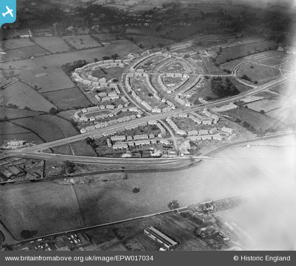
epw017034 ENGLAND (1926). The Pype Hayes and Tyburn Road area, Tyburn, 1926
© Copyright OpenStreetMap contributors and licensed by the OpenStreetMap Foundation. 2024. Cartography is licensed as CC BY-SA.
Nearby Images (3)
EPW017034

EPW017035

EPW017033

Details
| Title | [EPW017034] The Pype Hayes and Tyburn Road area, Tyburn, 1926 |
| Reference | EPW017034 |
| Date | 6-October-1926 |
| Link | |
| Place name | TYBURN |
| Parish | |
| District | |
| Country | ENGLAND |
| Easting / Northing | 412621, 291164 |
| Longitude / Latitude | -1.81398404558, 52.517847616136 |
| National Grid Reference | SP126912 |
Pins
 frothy |
Tuesday 14th of March 2023 05:34:23 PM | |
 nickhaw |
Monday 6th of January 2014 01:16:58 PM | |
 Class31 |
Wednesday 31st of October 2012 10:03:48 AM | |
Class31 |
Wednesday 31st of October 2012 10:03:10 AM | |
Class31 |
Wednesday 31st of October 2012 10:02:42 AM | |
Class31 |
Wednesday 31st of October 2012 10:02:07 AM | |
Class31 |
Wednesday 31st of October 2012 10:01:35 AM | |
Class31 |
Wednesday 31st of October 2012 10:01:15 AM | |
Class31 |
Wednesday 31st of October 2012 10:00:53 AM |


