
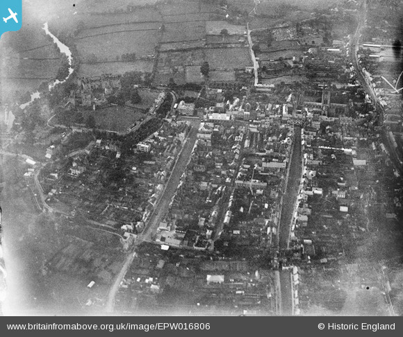
epw016806 ENGLAND (1926). The town centre, Ludlow, 1926
© Copyright OpenStreetMap contributors and licensed by the OpenStreetMap Foundation. 2024. Cartography is licensed as CC BY-SA.
Nearby Images (8)
EPW016806

EPW061922

EAW010352

EAW010355

EAW010353

EAW010349

EAW010351

EAW010354

Details
| Title | [EPW016806] The town centre, Ludlow, 1926 |
| Reference | EPW016806 |
| Date | August-1926 |
| Link | |
| Place name | LUDLOW |
| Parish | LUDLOW |
| District | |
| Country | ENGLAND |
| Easting / Northing | 351042, 274516 |
| Longitude / Latitude | -2.719102614677, 52.366122925266 |
| National Grid Reference | SO510745 |
Pins
 Andrew Bennett |
Monday 17th of June 2013 12:00:04 AM | |
Andrew Bennett |
Sunday 16th of June 2013 11:59:25 PM | |
Andrew Bennett |
Sunday 16th of June 2013 11:57:37 PM | |
Andrew Bennett |
Sunday 16th of June 2013 11:55:07 PM | |
Andrew Bennett |
Sunday 16th of June 2013 11:51:11 PM | |
copper |
Sunday 5th of May 2013 09:49:29 PM | |
copper |
Sunday 5th of May 2013 09:48:08 PM | |
Ted |
Wednesday 7th of November 2012 08:46:22 PM | |
Ted |
Tuesday 6th of November 2012 05:39:26 PM | |
 Class31 |
Monday 9th of July 2012 08:15:45 AM | |
Class31 |
Monday 9th of July 2012 08:14:06 AM | |
Class31 |
Monday 9th of July 2012 08:13:17 AM | |
Class31 |
Monday 9th of July 2012 08:12:06 AM | |
Class31 |
Monday 9th of July 2012 08:11:35 AM | |
Class31 |
Monday 9th of July 2012 08:10:46 AM |


