
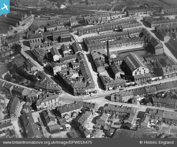
epw016475 ENGLAND (1926). The Albion Cotton Mill at Brook Bottom, Mossley, 1926
© Copyright OpenStreetMap contributors and licensed by the OpenStreetMap Foundation. 2024. Cartography is licensed as CC BY-SA.
Nearby Images (10)
EPW016475

EAW047869

EAW047873

EAW047870

EAW047871

EAW047874

EAW047866

EAW047867

EAW047872

EAW047868

Details
| Title | [EPW016475] The Albion Cotton Mill at Brook Bottom, Mossley, 1926 |
| Reference | EPW016475 |
| Date | August-1926 |
| Link | |
| Place name | MOSSLEY |
| Parish | MOSSLEY |
| District | |
| Country | ENGLAND |
| Easting / Northing | 397079, 402502 |
| Longitude / Latitude | -2.0440596028848, 53.518935459822 |
| National Grid Reference | SD971025 |
Pins
 dodo |
Saturday 2nd of October 2021 05:42:28 PM | |
David Beilby |
Friday 3rd of May 2013 06:25:55 PM | |
MB |
Saturday 15th of September 2012 03:19:13 PM | |
MB |
Saturday 15th of September 2012 03:18:24 PM | |
MB |
Saturday 15th of September 2012 03:17:18 PM | |
MB |
Saturday 15th of September 2012 03:16:53 PM | |
MB |
Saturday 15th of September 2012 03:16:15 PM |


