
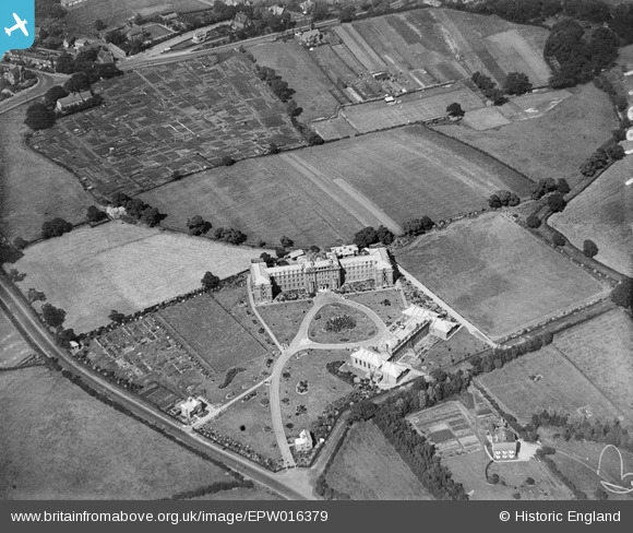
epw016379 ENGLAND (1926). Neville's Cross College, Durham, 1926
© Copyright OpenStreetMap contributors and licensed by the OpenStreetMap Foundation. 2024. Cartography is licensed as CC BY-SA.
Details
| Title | [EPW016379] Neville's Cross College, Durham, 1926 |
| Reference | EPW016379 |
| Date | 29-July-1926 |
| Link | |
| Place name | DURHAM |
| Parish | |
| District | |
| Country | ENGLAND |
| Easting / Northing | 426388, 541704 |
| Longitude / Latitude | -1.5897921982909, 54.769466478426 |
| National Grid Reference | NZ264417 |
Pins
 Ebo77 |
Friday 22nd of May 2020 06:34:46 PM | |
Chells809 |
Thursday 26th of June 2014 09:50:30 PM | |
Chells809 |
Thursday 26th of June 2014 09:50:01 PM | |
Chells809 |
Thursday 26th of June 2014 09:49:16 PM | |
Chells809 |
Thursday 26th of June 2014 09:47:32 PM | |
history group |
Thursday 22nd of August 2013 02:21:10 PM | |
Supramacie |
Sunday 8th of July 2012 09:44:58 PM |
User Comment Contributions
Most of this area now housing. College closed c2000(?) for upmarket housing with cracking views of the cathedral in places. Tennis club still survives. St Margerets school built at top of picture in 70's(?). |
Supramacie |
Sunday 8th of July 2012 09:48:36 PM |


