
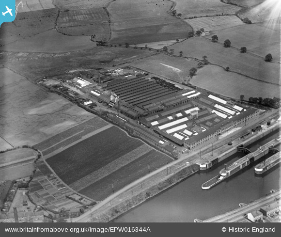
epw016344a ENGLAND (1926). The Richmond Gas Stove and Meter Works, Warrington, 1926
© Copyright OpenStreetMap contributors and licensed by the OpenStreetMap Foundation. 2024. Cartography is licensed as CC BY-SA.
Nearby Images (8)
EPW016344A

EPW016344

EPW027872

EPW027873

EPR000319

EPR000292

EAW008433

EAW008434

Details
| Title | [EPW016344A] The Richmond Gas Stove and Meter Works, Warrington, 1926 |
| Reference | EPW016344A |
| Date | July-1926 |
| Link | |
| Place name | WARRINGTON |
| Parish | |
| District | |
| Country | ENGLAND |
| Easting / Northing | 363620, 387445 |
| Longitude / Latitude | -2.5469909694477, 53.382335134383 |
| National Grid Reference | SJ636874 |
Pins
 Bottom Yard |
Sunday 13th of January 2019 04:08:20 PM | |
Bottom Yard |
Sunday 13th of January 2019 04:06:44 PM | |
Bottom Yard |
Sunday 13th of January 2019 04:05:48 PM | |
Bottom Yard |
Sunday 13th of January 2019 04:05:02 PM | |
Bottom Yard |
Sunday 13th of January 2019 04:04:00 PM | |
Aldo |
Sunday 23rd of February 2014 12:41:12 AM | |
Aldo |
Sunday 23rd of February 2014 12:40:50 AM |
User Comment Contributions
 This was siuated by Latchford Locks and was only demolished recently. Another good place to visit. |
Frank S |
Saturday 30th of June 2012 11:14:39 AM |


