
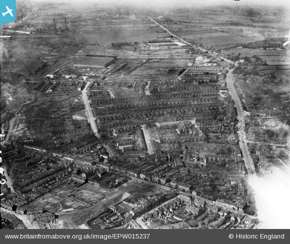
epw015237 ENGLAND (1926). St James's Church and environs, Handsworth, 1926
© Copyright OpenStreetMap contributors and licensed by the OpenStreetMap Foundation. 2024. Cartography is licensed as CC BY-SA.
Nearby Images (9)
EPW015237

EPW015235

EPW015239

EPW015238

EPW015234

EPW015233

EPW015232

EPW015236

EPW015231

Details
| Title | [EPW015237] St James's Church and environs, Handsworth, 1926 |
| Reference | EPW015237 |
| Date | 18-April-1926 |
| Link | |
| Place name | HANDSWORTH |
| Parish | |
| District | |
| Country | ENGLAND |
| Easting / Northing | 403467, 289651 |
| Longitude / Latitude | -1.9489168909314, 52.504379441767 |
| National Grid Reference | SP035897 |
Pins
 baggies |
Sunday 20th of July 2014 06:26:30 PM | |
baggies |
Sunday 20th of July 2014 06:25:11 PM | |
 Class31 |
Wednesday 6th of February 2013 04:27:08 PM | |
Class31 |
Wednesday 6th of February 2013 04:16:55 PM | |
Class31 |
Wednesday 6th of February 2013 04:16:39 PM | |
Class31 |
Wednesday 6th of February 2013 04:16:24 PM |


