
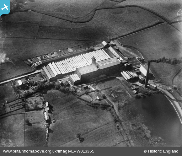
epw013365 ENGLAND (1925). Cuerden Cotton Mill and mill pond, Bamber Bridge, 1925
© Copyright OpenStreetMap contributors and licensed by the OpenStreetMap Foundation. 2025. Cartography is licensed as CC BY-SA.
Details
| Title | [EPW013365] Cuerden Cotton Mill and mill pond, Bamber Bridge, 1925 |
| Reference | EPW013365 |
| Date | June-1925 |
| Link | |
| Place name | BAMBER BRIDGE |
| Parish | |
| District | |
| Country | ENGLAND |
| Easting / Northing | 355828, 425452 |
| Longitude / Latitude | -2.6695107970522, 53.723377230414 |
| National Grid Reference | SD558255 |
Pins
 Preston Digital Archive |
Monday 29th of August 2016 09:08:10 PM |
User Comment Contributions
The row of mill workers cottages seen on the far side in the mill was known as Dewhurst's Row after the Mill owners George & R. Dewhurst. The cottages were separated from the weaving shed by a narrow road that contained a railway siding - https://www.flickr.com/photos/rpsmithbarney/11879523984/ |
Preston Digital Archive |
Monday 29th of August 2016 09:07:14 PM |