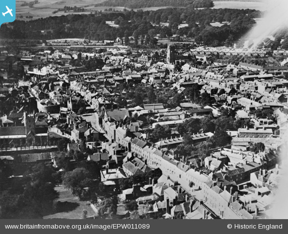
epw011089 ENGLAND (1924). The town centre, Devizes, 1924. This image has been produced from a copy-negative.
© Copyright OpenStreetMap contributors and licensed by the OpenStreetMap Foundation. 2024. Cartography is licensed as CC BY-SA.
Nearby Images (11)
EPW011089

EPW011084

EPW011085

EAW015072

EAW015073

EAW034906

EAW034904

EAW034908

EAW015074

EPW011086

EPW011088

Details
| Title | [EPW011089] The town centre, Devizes, 1924. This image has been produced from a copy-negative. |
| Reference | EPW011089 |
| Date | July-1924 |
| Link | |
| Place name | DEVIZES |
| Parish | DEVIZES |
| District | |
| Country | ENGLAND |
| Easting / Northing | 400556, 161327 |
| Longitude / Latitude | -1.9920152675382, 51.350519755519 |
| National Grid Reference | SU006613 |
Pins
 Class31 |
Sunday 22nd of February 2015 05:08:33 PM |