
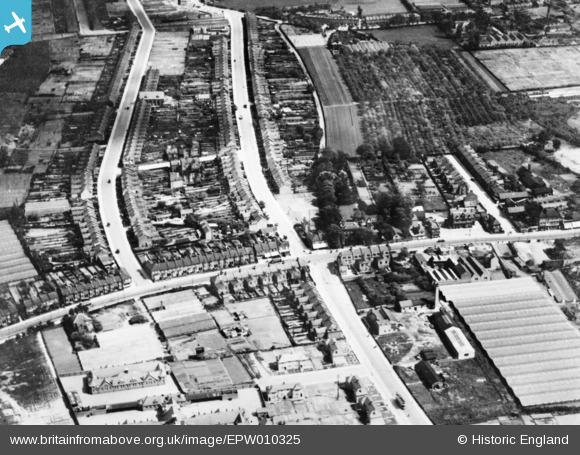
epw010325 ENGLAND (1924). Nags Head Road, Ponders End, 1924. This image has been produced from a copy-negative.
© Copyright OpenStreetMap contributors and licensed by the OpenStreetMap Foundation. 2024. Cartography is licensed as CC BY-SA.
Details
| Title | [EPW010325] Nags Head Road, Ponders End, 1924. This image has been produced from a copy-negative. |
| Reference | EPW010325 |
| Date | April-1924 |
| Link | |
| Place name | PONDERS END |
| Parish | |
| District | |
| Country | ENGLAND |
| Easting / Northing | 535318, 196198 |
| Longitude / Latitude | -0.043922954309418, 51.647805656846 |
| National Grid Reference | TQ353962 |
Pins
 Wingrs |
Sunday 14th of February 2021 04:36:52 PM | |
Nowy Paul |
Saturday 30th of December 2017 02:51:38 PM | |
 Class31 |
Monday 31st of August 2015 11:19:56 AM | |
David Knight |
Tuesday 26th of May 2015 01:59:52 PM | |
josecadaveira |
Monday 13th of October 2014 05:03:43 PM | |
Grk |
Monday 1st of September 2014 07:51:09 PM | |
Grk |
Monday 1st of September 2014 07:49:33 PM | |
Grk |
Monday 1st of September 2014 07:48:34 PM | |
Grk |
Monday 1st of September 2014 07:45:13 PM |


