
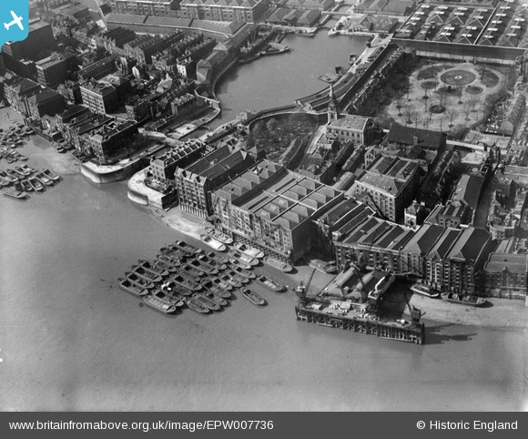
epw007736 ENGLAND (1922). Wapping Basin and riverside warehouses on the High Street, Wapping, 1922
© Copyright OpenStreetMap contributors and licensed by the OpenStreetMap Foundation. 2024. Cartography is licensed as CC BY-SA.
Nearby Images (11)
EPW007736

EPW007738

EPW007734

EPW007737

EPW007735

EPW032750

EPW060800

EPW059931

EAW016652

EPW032751

EPW032748

Details
| Title | [EPW007736] Wapping Basin and riverside warehouses on the High Street, Wapping, 1922 |
| Reference | EPW007736 |
| Date | April-1922 |
| Link | |
| Place name | WAPPING |
| Parish | |
| District | |
| Country | ENGLAND |
| Easting / Northing | 534668, 180012 |
| Longitude / Latitude | -0.059519704957386, 51.502494707593 |
| National Grid Reference | TQ347800 |
Pins
 chainbull |
Saturday 9th of August 2014 08:23:33 AM | |
S00Z |
Wednesday 18th of September 2013 10:53:53 PM | |
S00Z |
Wednesday 18th of September 2013 10:47:46 PM | |
Chelsea61 |
Wednesday 26th of June 2013 06:36:00 PM |


