
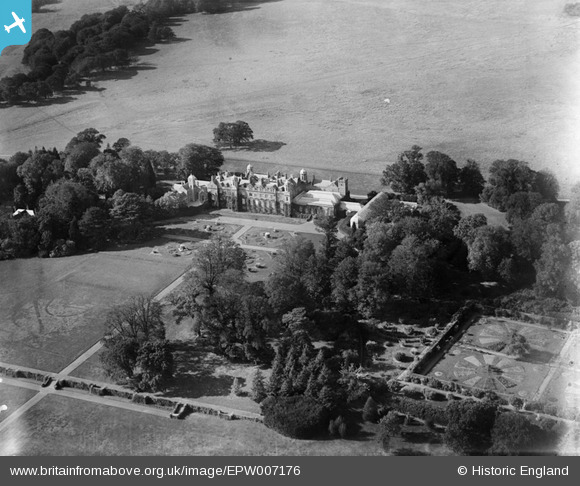
epw007176 ENGLAND (1921). Eastwell Park House, Eastwell Park, 1921
© Copyright OpenStreetMap contributors and licensed by the OpenStreetMap Foundation. 2024. Cartography is licensed as CC BY-SA.
Nearby Images (7)
EPW007176

EPW007178

EPW007173

EPW007175

EPW007171

EPW007179

EPW007177

Details
| Title | [EPW007176] Eastwell Park House, Eastwell Park, 1921 |
| Reference | EPW007176 |
| Date | 6-October-1921 |
| Link | |
| Place name | EASTWELL PARK |
| Parish | EASTWELL |
| District | |
| Country | ENGLAND |
| Easting / Northing | 601706, 147517 |
| Longitude / Latitude | 0.88693620830414, 51.190705252156 |
| National Grid Reference | TR017475 |
Pins
Be the first to add a comment to this image!


