
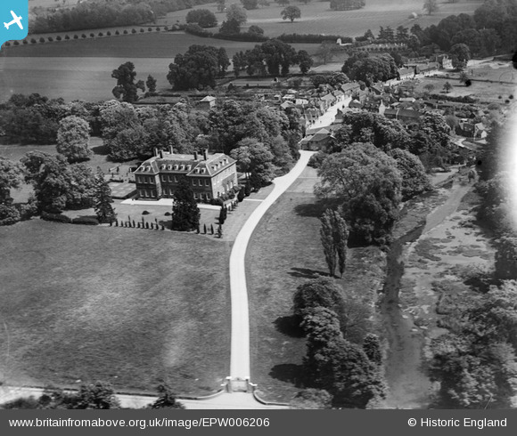
epw006206 ENGLAND (1921). Denham Place and the village, Denham, 1921
© Copyright OpenStreetMap contributors and licensed by the OpenStreetMap Foundation. 2024. Cartography is licensed as CC BY-SA.
Nearby Images (2)
EPW006206

EPW005688

Details
| Title | [EPW006206] Denham Place and the village, Denham, 1921 |
| Reference | EPW006206 |
| Date | April-1921 |
| Link | |
| Place name | DENHAM |
| Parish | DENHAM |
| District | |
| Country | ENGLAND |
| Easting / Northing | 503917, 187128 |
| Longitude / Latitude | -0.50033364718247, 51.57295557579 |
| National Grid Reference | TQ039871 |
Pins
 Sam |
Tuesday 23rd of February 2016 01:09:14 AM | |
 |
C Carter |
Saturday 25th of July 2015 04:55:14 PM |
C Carter |
Saturday 25th of July 2015 04:45:43 PM | |
moses72 |
Thursday 14th of August 2014 05:01:08 PM | |
Island Cottages, demolished in the 1950s |
C Carter |
Saturday 25th of July 2015 04:42:01 PM |


