
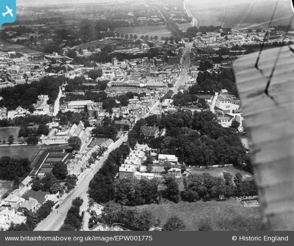
epw001775 ENGLAND (1920). High Street, Newmarket, 1920
© Copyright OpenStreetMap contributors and licensed by the OpenStreetMap Foundation. 2024. Cartography is licensed as CC BY-SA.
Nearby Images (2)
EPW001775

EPW001754

Details
| Title | [EPW001775] High Street, Newmarket, 1920 |
| Reference | EPW001775 |
| Date | June-1920 |
| Link | |
| Place name | NEWMARKET |
| Parish | NEWMARKET |
| District | |
| Country | ENGLAND |
| Easting / Northing | 564016, 263141 |
| Longitude / Latitude | 0.40250215120457, 52.241584351743 |
| National Grid Reference | TL640631 |
Pins
 Bedford1944 |
Thursday 6th of February 2014 08:46:29 PM | |
Bedford1944 |
Thursday 6th of February 2014 08:44:22 PM |


