
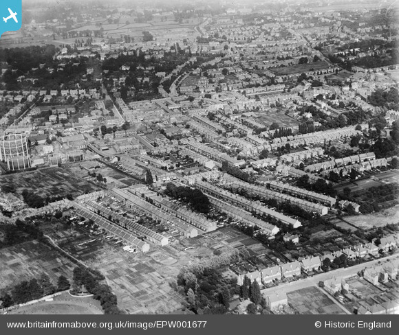
epw001677 ENGLAND (1920). Collingwood Road and Gas Works area of Sutton, Sutton, 1920
© Copyright OpenStreetMap contributors and licensed by the OpenStreetMap Foundation. 2024. Cartography is licensed as CC BY-SA.
Details
| Title | [EPW001677] Collingwood Road and Gas Works area of Sutton, Sutton, 1920 |
| Reference | EPW001677 |
| Date | June-1920 |
| Link | |
| Place name | SUTTON |
| Parish | |
| District | |
| Country | ENGLAND |
| Easting / Northing | 525508, 164565 |
| Longitude / Latitude | -0.19691221048609, 51.365763756046 |
| National Grid Reference | TQ255646 |
Pins
 jam an |
Thursday 14th of May 2015 09:20:02 PM | |
Whitley Worker |
Tuesday 14th of January 2014 01:55:52 PM | |
AnnS |
Saturday 11th of January 2014 07:00:30 PM | |
roberttheprune |
Saturday 11th of January 2014 09:55:05 AM | |
Mark1973 |
Tuesday 27th of August 2013 02:24:58 PM | |
christhewino |
Sunday 28th of July 2013 11:35:50 AM | |
christhewino |
Friday 28th of December 2012 09:30:33 PM | |
christhewino |
Friday 28th of December 2012 09:29:37 PM | |
christhewino |
Friday 28th of December 2012 09:28:41 PM | |
christhewino |
Friday 28th of December 2012 09:25:11 PM | |
christhewino |
Friday 28th of December 2012 09:24:30 PM | |
christhewino |
Monday 17th of December 2012 12:04:37 PM | |
christhewino |
Monday 17th of December 2012 12:03:59 PM | |
christhewino |
Monday 17th of December 2012 12:01:52 PM | |
christhewino |
Monday 17th of December 2012 11:52:42 AM | |
That's Brunswick Rd. Lewis Road is one at before this |
Jay |
Tuesday 18th of April 2023 01:25:26 PM |
christhewino |
Monday 17th of December 2012 11:51:44 AM | |
Falcon |
Sunday 21st of October 2012 01:59:49 PM | |
I'm pretty certain that this is not the Conservative Club, the club would have been further round Benhill Rd. This building is also facing the wrong direction. |
christhewino |
Monday 17th of December 2012 12:09:27 PM |
This was the Congregational Church in Benhill Street. |
Mark1973 |
Tuesday 27th of August 2013 02:12:27 PM |
Geoff Smith |
Wednesday 3rd of October 2012 07:34:59 PM | |
Geoff Smith |
Wednesday 3rd of October 2012 07:34:18 PM | |
Geoff Smith |
Wednesday 3rd of October 2012 07:32:59 PM | |
gas69 |
Sunday 22nd of July 2012 07:38:00 PM | |
Mark1973 |
Thursday 28th of June 2012 04:49:41 PM | |
Mark1973 |
Thursday 28th of June 2012 04:48:00 PM | |
Mark1973 |
Thursday 28th of June 2012 04:46:56 PM | |
Mark1973 |
Thursday 28th of June 2012 04:46:04 PM | |
Mark1973 |
Thursday 28th of June 2012 04:45:04 PM | |
Mark1973 |
Thursday 28th of June 2012 04:42:55 PM | |
Mark1973 |
Thursday 28th of June 2012 04:41:54 PM | |
Mark1973 |
Thursday 28th of June 2012 04:41:27 PM | |
Mark1973 |
Thursday 28th of June 2012 04:40:52 PM | |
Mark1973 |
Thursday 28th of June 2012 04:40:02 PM |
User Comment Contributions
Approx 200 yards to the left of these gasholders was 299 High Street- the offices of The Sutton Gas Company, later to become the Wandsworth & District Gas Company. On being Nationalised in 1948 it became The South Eastern Gas Board (West Surrey Division), for whom I worked as a clerk in the Sales & Service Department. Circa 1960 we were transferred en bloc to the Epsom offices at 19/21 East Street, leaving the Sutton site as more or less a gasholder station. The Sutton offices and the adjacent Station Engineer's (etc) houses were later destroyed to make way for the Eagle Star tower block. Gone were noise, the soot and smells of coal gas manufacture- along with the cameraderie of the works and office staff. Bill Mallion 1 April 2014 |
Bill Mallion |
Tuesday 1st of April 2014 11:07:42 AM |


