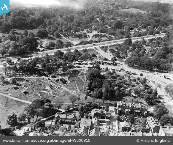
epw000815 ENGLAND (1920). Spaniards Road, Vale of Heath, Hampstead, 1920
© Copyright OpenStreetMap contributors and licensed by the OpenStreetMap Foundation. 2024. Cartography is licensed as CC BY-SA.
Nearby Images (14)
EPW000815

EPW016652

EPW005126

EPW026948

EPW028171

EPW000430

EPW056652

EAW000612

EPW009353

EPW005118

EPW000818

EPW013228

EPW020197

EPW020197
Details
| Title | [EPW000815] Spaniards Road, Vale of Heath, Hampstead, 1920 |
| Reference | EPW000815 |
| Date | May-1920 |
| Link | |
| Place name | HAMPSTEAD HEATH |
| Parish | |
| District | |
| Country | ENGLAND |
| Easting / Northing | 526407, 186587 |
| Longitude / Latitude | -0.17612769370813, 51.563498538237 |
| National Grid Reference | TQ264866 |
Pins
 Class31 |
Wednesday 22nd of October 2014 09:00:24 AM |