
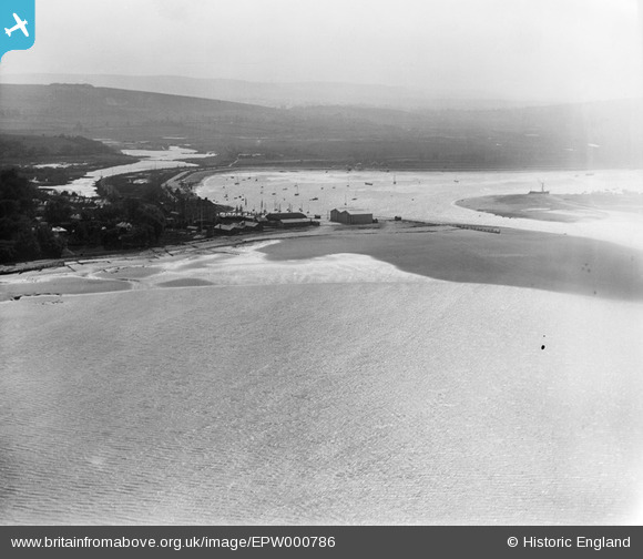
epw000786 ENGLAND (1920). Bembridge Harbour, Bembridge, from the north east, 1920
© Copyright OpenStreetMap contributors and licensed by the OpenStreetMap Foundation. 2024. Cartography is licensed as CC BY-SA.
Nearby Images (2)
EPW000786

EPW042969

Details
| Title | [EPW000786] Bembridge Harbour, Bembridge, from the north east, 1920 |
| Reference | EPW000786 |
| Date | April-1920 |
| Link | |
| Place name | BEMBRIDGE |
| Parish | BEMBRIDGE |
| District | |
| Country | ENGLAND |
| Easting / Northing | 464511, 89064 |
| Longitude / Latitude | -1.0864817441242, 50.697062482348 |
| National Grid Reference | SZ645891 |
Pins
User Comment Contributions
View to the west showing Bembridge Harbour Entrance, Bembridge Point, and the Royal Spithead Hotel. Embankment and the Railway stretching away round the Harbour. |
 pxrobbo |
Friday 3rd of August 2012 01:33:33 PM |
Dear all, That’s great; we’ve reviewed your comments and thanks to your help we can update the catalogue. The revised record will appear here in due course. Hope you have the same success solving some of our other mysteries! Katy Whitaker Britain from Above Cataloguer |
Katy Whitaker |
Monday 2nd of July 2012 12:34:49 PM |
 Bembridge Harbour Spithead with Royal Spithead Hotel in Shadow. Also visible, Royal Flying Corps (RFC) Bembridge Seaplane Hangers, which closed as an operational base in 1920. |
Ross Naylor |
Tuesday 26th of June 2012 09:10:26 PM |
Bembridge Harbour looking over Bembridge Point south over Brading Marsh. Culver Down with Bembridge Fort in top left hand corner. |
Wynnstow |
Tuesday 26th of June 2012 02:07:59 PM |
Looking SW into Bembridge Harbour, Isle of Wight. |
Hillzider |
Tuesday 26th of June 2012 01:32:31 PM |
Bembridge Point, Isle of Wight |
Tony D |
Tuesday 26th of June 2012 12:20:59 PM |


