
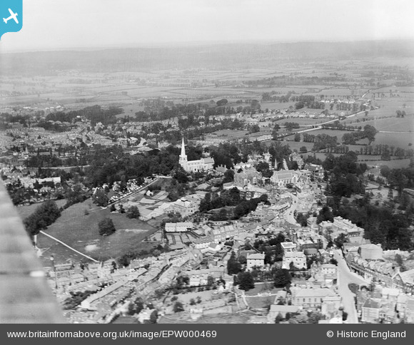
epw000469 ENGLAND (1920). Harrow on the Hill, from the south-west, 1920
© Copyright OpenStreetMap contributors and licensed by the OpenStreetMap Foundation. 2024. Cartography is licensed as CC BY-SA.
Nearby Images (24)
EPW000469

EPW053679

EPW000468

EPW000467

EAW024232

EPW025547

EPW000462

EPW000461

EAW042768

EAW024233

EPW000463

EPW053680

EAW042771

EAW014888

EPW005357

EAW042772

EAW042770

EPW006290

EPW006295

EPW018764

EPW005356

EAW014885

EAW042769

EAW042767

Details
| Title | [EPW000469] Harrow on the Hill, from the south-west, 1920 |
| Reference | EPW000469 |
| Date | April-1920 |
| Link | |
| Place name | HARROW ON THE HILL |
| Parish | |
| District | |
| Country | ENGLAND |
| Easting / Northing | 515166, 187244 |
| Longitude / Latitude | -0.33802687528225, 51.571812173161 |
| National Grid Reference | TQ152872 |
Pins
 The Laird |
Wednesday 19th of February 2020 09:17:03 PM | |
Robo |
Wednesday 22nd of February 2017 05:19:14 PM | |
The Laird |
Tuesday 10th of January 2017 10:59:39 PM | |
The Laird |
Tuesday 10th of January 2017 10:58:28 PM | |
The Laird |
Tuesday 10th of January 2017 10:44:14 PM | |
The Laird |
Tuesday 10th of January 2017 10:31:10 PM | |
The Laird |
Tuesday 10th of January 2017 10:25:48 PM | |
The Laird |
Tuesday 10th of January 2017 10:21:58 PM | |
The Laird |
Tuesday 10th of January 2017 10:15:03 PM | |
The Laird |
Tuesday 10th of January 2017 10:10:26 PM | |
Sweet Pete |
Tuesday 10th of November 2015 01:56:31 PM | |
Sweet Pete |
Tuesday 10th of November 2015 01:44:31 PM |


