
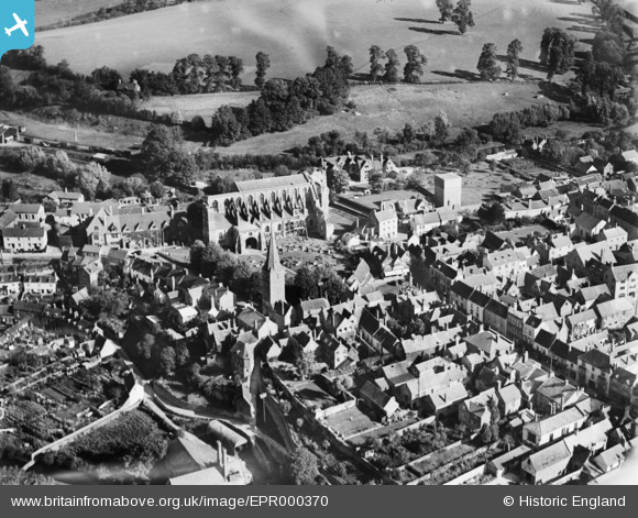
epr000370 ENGLAND (1934). St Mary and St Aldhelm's Abbey Church and the town, Malmesbury, 1934
© Copyright OpenStreetMap contributors and licensed by the OpenStreetMap Foundation. 2024. Cartography is licensed as CC BY-SA.
Nearby Images (4)
EPR000370

EAW018022

EAW018021

EPW032620

Details
| Title | [EPR000370] St Mary and St Aldhelm's Abbey Church and the town, Malmesbury, 1934 |
| Reference | EPR000370 |
| Date | 28-September-1934 |
| Link | |
| Place name | MALMESBURY |
| Parish | MALMESBURY |
| District | |
| Country | ENGLAND |
| Easting / Northing | 393291, 187294 |
| Longitude / Latitude | -2.0968411243235, 51.583989817509 |
| National Grid Reference | ST933873 |
Pins
Be the first to add a comment to this image!
User Comment Contributions
 Malmesbury Cross, 08/08/2014 |
 Class31 |
Sunday 20th of March 2016 11:39:05 AM |


