
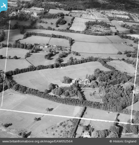
eaw052564 ENGLAND (1953). The Bennett Memorial Diocesan School and environs, Royal Tunbridge Wells, 1953
© Copyright OpenStreetMap contributors and licensed by the OpenStreetMap Foundation. 2024. Cartography is licensed as CC BY-SA.
Nearby Images (8)
EAW052564

EAW052563

EAW052565

EAW052561

EAW052566

EAW052560

EAW052559

EAW052562

Details
| Title | [EAW052564] The Bennett Memorial Diocesan School and environs, Royal Tunbridge Wells, 1953 |
| Reference | EAW052564 |
| Date | 2-October-1953 |
| Link | |
| Place name | ROYAL TUNBRIDGE WELLS |
| Parish | |
| District | |
| Country | ENGLAND |
| Easting / Northing | 557271, 140714 |
| Longitude / Latitude | 0.24858000434673, 51.143532961375 |
| National Grid Reference | TQ573407 |
Pins
User Comment Contributions
For more information on the Bennett Memorial Diocesan School see http://en.wikipedia.org/wiki/Bennett_Memorial_Diocesan_School The school was founded on 17th October 1951 and opened to students on 8th January 1953. |
 Class31 |
Tuesday 4th of November 2014 04:30:34 PM |
The view is looking north. |
Class31 |
Tuesday 4th of November 2014 04:27:04 PM |
This is the Bennett Memorial Diocesan School in Royal Tunbridge Wells, Kent, England. |
Class31 |
Tuesday 4th of November 2014 03:58:45 PM |
EAW052559 EAW052560 EAW052561 EAW052562 EAW052563 EAW052564 EAW052565 EAW052566 are all of the same area which looks like a Girls' school. |
Class31 |
Monday 3rd of November 2014 03:55:25 PM |


