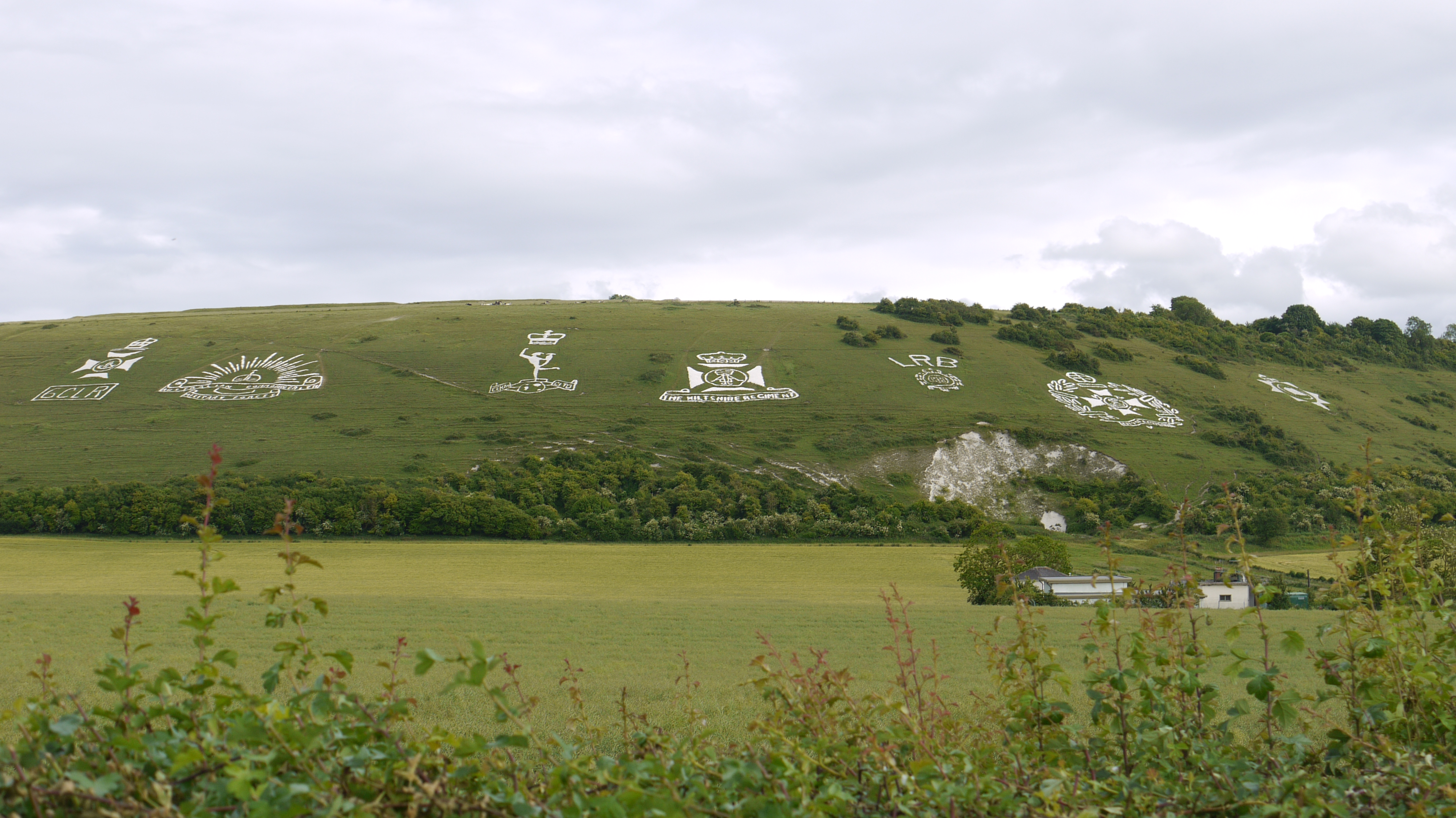
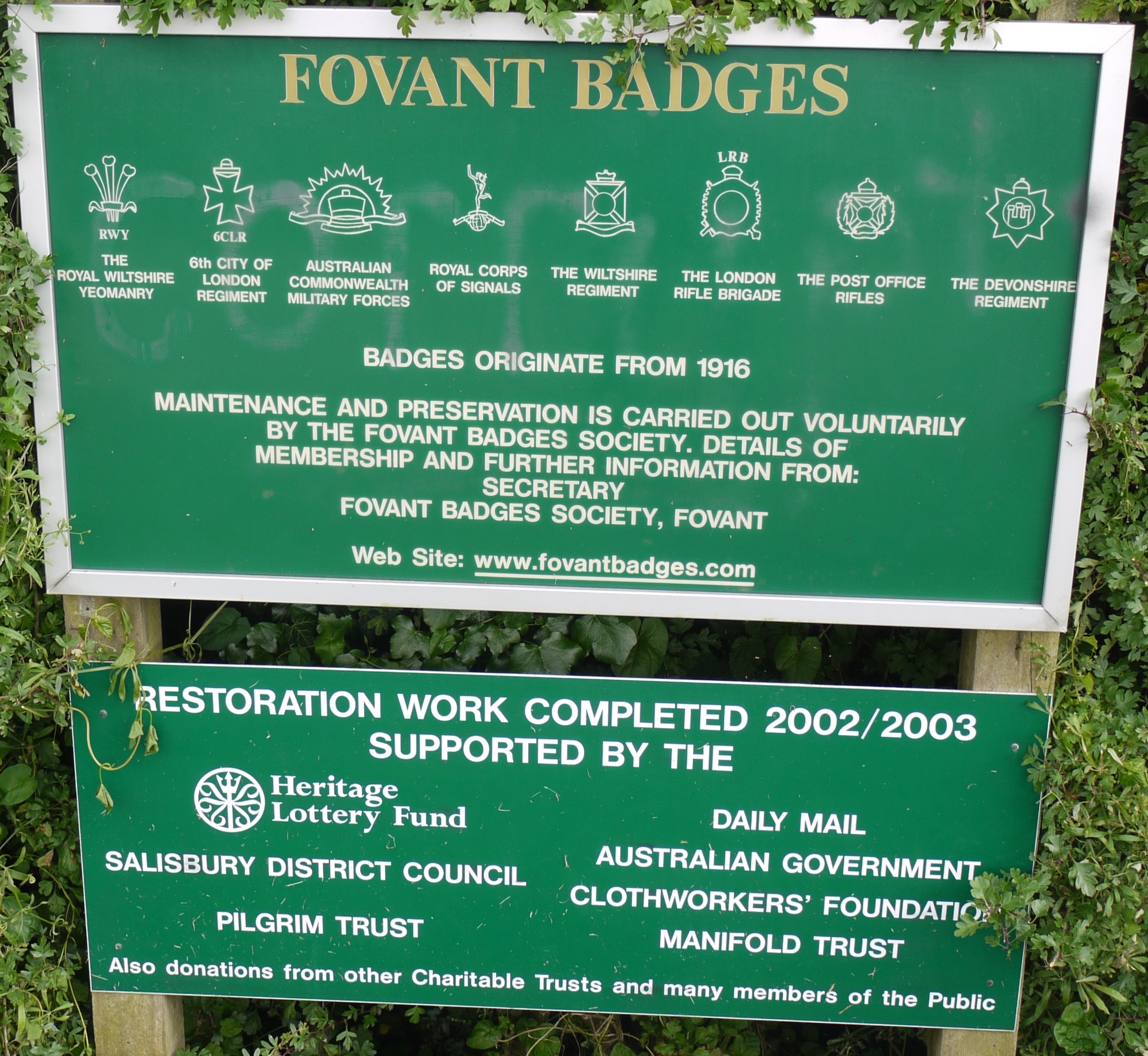
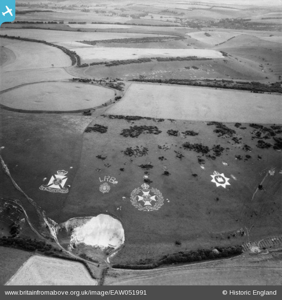
eaw051991 ENGLAND (1953). The Fovant Badges and Chiselbury Camp, Fovant, 1953
© Copyright OpenStreetMap contributors and licensed by the OpenStreetMap Foundation. 2024. Cartography is licensed as CC BY-SA.
Nearby Images (6)
EAW051991

EAW051994

EAW051995

EAW005104

EAW031929

EAW051989

Details
| Title | [EAW051991] The Fovant Badges and Chiselbury Camp, Fovant, 1953 |
| Reference | EAW051991 |
| Date | 5-September-1953 |
| Link | |
| Place name | FOVANT |
| Parish | FOVANT |
| District | |
| Country | ENGLAND |
| Easting / Northing | 401497, 128115 |
| Longitude / Latitude | -1.9786401158138, 51.051843663742 |
| National Grid Reference | SU015281 |
Pins
Be the first to add a comment to this image!