
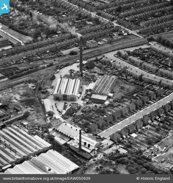
eaw050639 ENGLAND (1953). Southbury Smelting Works, Enfield, 1953
© Copyright OpenStreetMap contributors and licensed by the OpenStreetMap Foundation. 2024. Cartography is licensed as CC BY-SA.
Nearby Images (7)
EAW050639

EAW050638

EAW050637

EAW050642

EAW050641

EAW050643

EAW050640

Details
| Title | [EAW050639] Southbury Smelting Works, Enfield, 1953 |
| Reference | EAW050639 |
| Date | 15-July-1953 |
| Link | |
| Place name | ENFIELD |
| Parish | |
| District | |
| Country | ENGLAND |
| Easting / Northing | 534704, 195959 |
| Longitude / Latitude | -0.052885091307986, 51.645805200817 |
| National Grid Reference | TQ347960 |
Pins
Be the first to add a comment to this image!


