
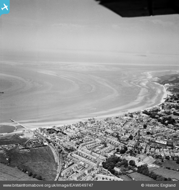
eaw049747 ENGLAND (1953). Bridgewater Bay, Burnham-on-Sea, from the south-east, 1953
© Copyright OpenStreetMap contributors and licensed by the OpenStreetMap Foundation. 2024. Cartography is licensed as CC BY-SA.
Nearby Images (3)
EAW049747

EAW049742

EPW039927

Details
| Title | [EAW049747] Bridgewater Bay, Burnham-on-Sea, from the south-east, 1953 |
| Reference | EAW049747 |
| Date | 28-May-1953 |
| Link | |
| Place name | BURNHAM-ON-SEA |
| Parish | BURNHAM-ON-SEA AND HIGHBRIDGE |
| District | |
| Country | ENGLAND |
| Easting / Northing | 330575, 148867 |
| Longitude / Latitude | -2.9945101625081, 51.234244451331 |
| National Grid Reference | ST306489 |


