
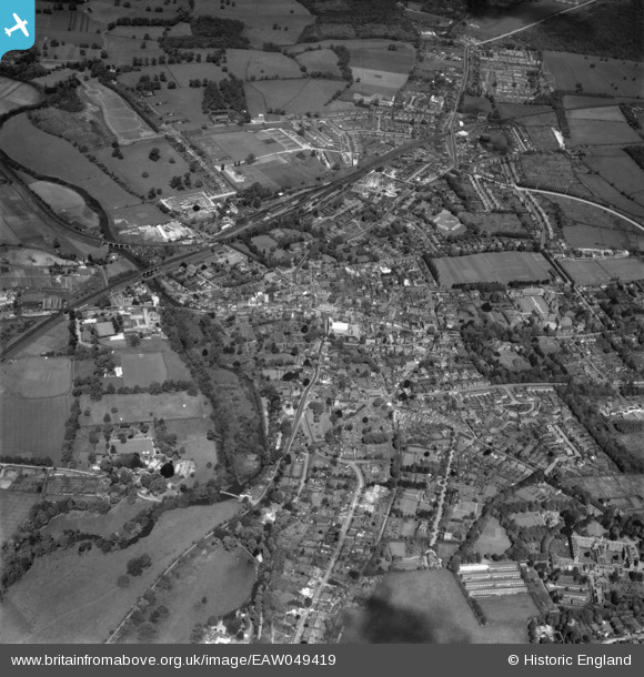
eaw049419 ENGLAND (1953). The town, Leatherhead, 1953
© Copyright OpenStreetMap contributors and licensed by the OpenStreetMap Foundation. 2024. Cartography is licensed as CC BY-SA.
Nearby Images (12)
EAW049419

EAW049417

EPW032798

EPW057010

EPW006233

EPW057012

EPW006232

EPW025240

EPW032799

EPW025241

EPW001718

EAW049420

Details
| Title | [EAW049419] The town, Leatherhead, 1953 |
| Reference | EAW049419 |
| Date | 19-May-1953 |
| Link | |
| Place name | LEATHERHEAD |
| Parish | |
| District | |
| Country | ENGLAND |
| Easting / Northing | 516586, 156410 |
| Longitude / Latitude | -0.32769688709712, 51.294361056504 |
| National Grid Reference | TQ166564 |
Pins
Be the first to add a comment to this image!


