
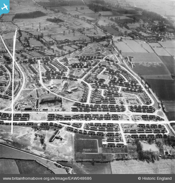
eaw048686 ENGLAND (1953). Council estate under construction, Clifton, 1953. This image was marked by Aerofilms Ltd for photo editing.
© Copyright OpenStreetMap contributors and licensed by the OpenStreetMap Foundation. 2024. Cartography is licensed as CC BY-SA.
Nearby Images (8)
EAW048686

EAW048681

EAW048684

EAW048685

EAW048680

EAW048687

EAW048682

EAW048679

Details
| Title | [EAW048686] Council estate under construction, Clifton, 1953. This image was marked by Aerofilms Ltd for photo editing. |
| Reference | EAW048686 |
| Date | 3-April-1953 |
| Link | |
| Place name | CLIFTON |
| Parish | |
| District | |
| Country | ENGLAND |
| Easting / Northing | 455548, 335265 |
| Longitude / Latitude | -1.1738873685966, 52.91161834747 |
| National Grid Reference | SK555353 |
Pins
 KC |
Thursday 30th of November 2023 09:26:45 AM | |
KC |
Thursday 30th of November 2023 09:26:22 AM | |
Riddo27 |
Sunday 22nd of May 2022 07:23:36 PM | |
Riddo27 |
Sunday 22nd of May 2022 07:21:56 PM | |
Riddo27 |
Sunday 22nd of May 2022 07:20:23 PM | |
KC |
Saturday 14th of May 2022 10:10:33 AM | |
KC |
Tuesday 19th of April 2022 02:07:45 PM | |
KC |
Monday 21st of June 2021 06:45:21 PM | |
KC |
Monday 21st of June 2021 06:45:03 PM | |
james |
Monday 12th of December 2016 07:04:12 PM | |
John W |
Sunday 18th of September 2016 01:12:13 PM |


