
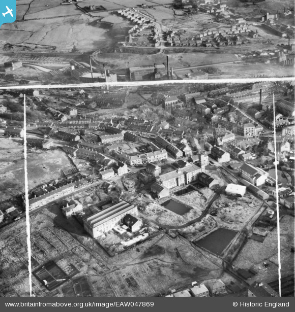
eaw047869 ENGLAND (1952). Hare and Brookbottom Cotton Mills and environs, Mossley, 1952. This image was marked by Aerofilms Ltd for photo editing.
© Copyright OpenStreetMap contributors and licensed by the OpenStreetMap Foundation. 2024. Cartography is licensed as CC BY-SA.
Nearby Images (10)
EAW047869

EAW047873

EAW047871

EAW047870

EAW047866

EAW047868

EAW047872

EAW047867

EAW047874

EPW016475

Details
| Title | [EAW047869] Hare and Brookbottom Cotton Mills and environs, Mossley, 1952. This image was marked by Aerofilms Ltd for photo editing. |
| Reference | EAW047869 |
| Date | 11-November-1952 |
| Link | |
| Place name | MOSSLEY |
| Parish | MOSSLEY |
| District | |
| Country | ENGLAND |
| Easting / Northing | 397019, 402655 |
| Longitude / Latitude | -2.0449660832502, 53.520310505583 |
| National Grid Reference | SD970027 |
Pins
 Class31 |
Thursday 5th of June 2014 06:24:01 PM | |
Class31 |
Thursday 5th of June 2014 06:07:06 PM | |
Class31 |
Thursday 5th of June 2014 05:41:12 PM | |
Class31 |
Thursday 5th of June 2014 05:36:49 PM | |
Class31 |
Thursday 5th of June 2014 05:32:50 PM | |
Class31 |
Thursday 5th of June 2014 05:15:45 PM | |
Class31 |
Thursday 5th of June 2014 05:11:23 PM | |
Hi Class31, Thanks for the useful pins on this one. We'll update the catalogue and post the new data here in due course. Yours, Katy Britain from Above Cataloguing Team Leader |
Katy Whitaker |
Monday 30th of June 2014 03:32:21 PM |
User Comment Contributions
View looking south east. |
Class31 |
Thursday 5th of June 2014 05:56:04 PM |


