
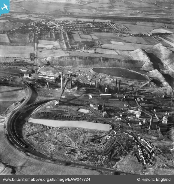
eaw047724 ENGLAND (1952). Grassmoor Colliery and the village, Grassmoor, 1952
© Copyright OpenStreetMap contributors and licensed by the OpenStreetMap Foundation. 2024. Cartography is licensed as CC BY-SA.
Nearby Images (4)
EAW047724

EAW047726

EAW047725

EAW047723

Details
| Title | [EAW047724] Grassmoor Colliery and the village, Grassmoor, 1952 |
| Reference | EAW047724 |
| Date | 31-October-1952 |
| Link | |
| Place name | GRASSMOOR |
| Parish | GRASSMOOR, HASLAND AND WINSWICK |
| District | |
| Country | ENGLAND |
| Easting / Northing | 441063, 367458 |
| Longitude / Latitude | -1.3851871944745, 53.202323553525 |
| National Grid Reference | SK411675 |
Pins
 John Wass |
Tuesday 8th of November 2016 02:21:56 PM |


