
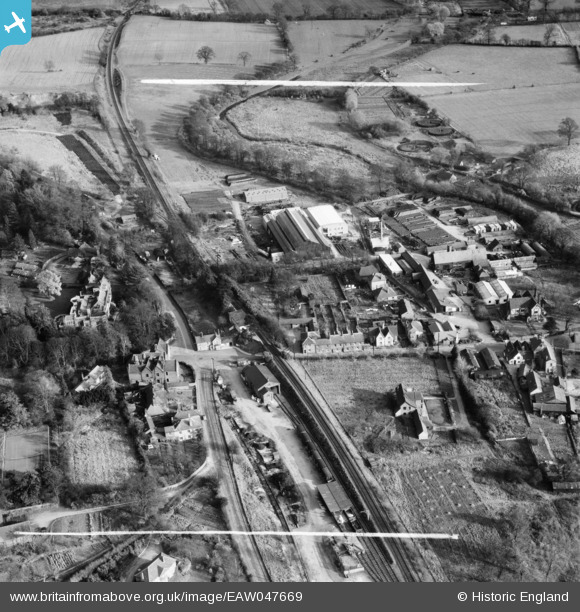
eaw047669 ENGLAND (1952). Wheathampstead House, the Murphy Chemical Co Works and environs, Wheathampstead, 1952. This image was marked by Aerofilms Ltd for photo editing.
© Copyright OpenStreetMap contributors and licensed by the OpenStreetMap Foundation. 2024. Cartography is licensed as CC BY-SA.
Nearby Images (16)
EAW047669

EAW047662

EAW047666

EAW047663

EAW047664

EAW047665

EAW047668

EAW047661

EAW047658

EAW047667

EAW047659

EAW047660

EAW015567

EAW000869

EAW015565

EAW000870

Details
| Title | [EAW047669] Wheathampstead House, the Murphy Chemical Co Works and environs, Wheathampstead, 1952. This image was marked by Aerofilms Ltd for photo editing. |
| Reference | EAW047669 |
| Date | 3-November-1952 |
| Link | |
| Place name | WHEATHAMPSTEAD |
| Parish | WHEATHAMPSTEAD |
| District | |
| Country | ENGLAND |
| Easting / Northing | 517827, 214314 |
| Longitude / Latitude | -0.29049930477, 51.81457350939 |
| National Grid Reference | TL178143 |
Pins
Be the first to add a comment to this image!


