
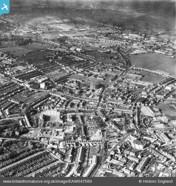
eaw047589 ENGLAND (1952). The town centre, Mitcham, 1952
© Copyright OpenStreetMap contributors and licensed by the OpenStreetMap Foundation. 2024. Cartography is licensed as CC BY-SA.
Nearby Images (2)
EAW047589

EPW055282

Details
| Title | [EAW047589] The town centre, Mitcham, 1952 |
| Reference | EAW047589 |
| Date | 23-October-1952 |
| Link | |
| Place name | MITCHAM |
| Parish | |
| District | |
| Country | ENGLAND |
| Easting / Northing | 527374, 169149 |
| Longitude / Latitude | -0.16847470714171, 51.40654965038 |
| National Grid Reference | TQ274691 |
Pins
Be the first to add a comment to this image!


