
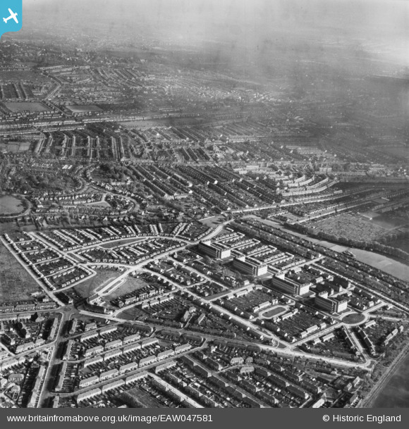
eaw047581 ENGLAND (1952). Pollards Hill, Mitcham, from the west, 1952
© Copyright OpenStreetMap contributors and licensed by the OpenStreetMap Foundation. 2024. Cartography is licensed as CC BY-SA.
Nearby Images (5)
EAW047581

EAW047582

EAW047580

EAW047579

EAW047583

Details
| Title | [EAW047581] Pollards Hill, Mitcham, from the west, 1952 |
| Reference | EAW047581 |
| Date | 23-October-1952 |
| Link | |
| Place name | MITCHAM |
| Parish | |
| District | |
| Country | ENGLAND |
| Easting / Northing | 530030, 168197 |
| Longitude / Latitude | -0.13065437605414, 51.397390348954 |
| National Grid Reference | TQ300682 |


