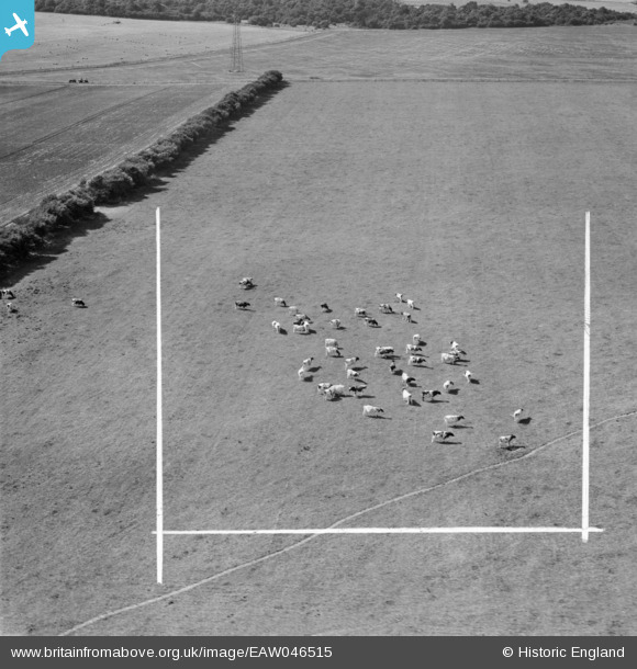
eaw046515 ENGLAND (1952). Cattle grazing near Cow Lane, Great Shoddesden, 1952. This image was marked by Aerofilms Ltd for photo editing.
© Copyright OpenStreetMap contributors and licensed by the OpenStreetMap Foundation. 2024. Cartography is licensed as CC BY-SA.
Details
| Title | [EAW046515] Cattle grazing near Cow Lane, Great Shoddesden, 1952. This image was marked by Aerofilms Ltd for photo editing. |
| Reference | EAW046515 |
| Date | 29-August-1952 |
| Link | |
| Place name | GREAT SHODDESDEN |
| Parish | KIMPTON |
| District | |
| Country | ENGLAND |
| Easting / Northing | 427220, 148474 |
| Longitude / Latitude | -1.6100778734795, 51.234285778988 |
| National Grid Reference | SU272485 |
Pins
 Andrew Bennett |
Tuesday 17th of June 2014 01:01:37 AM |
User Comment Contributions
Hi Andrew, Thanks for taking the time to look at this group of images. They are part of a large batch commissioned by WE and AT Cave Ltd, some of which we sited but many of which are like this; very few or no control points, and with no location information in the original Aerofilms Ltd Register. So it’s really good to be able to put them onto the map. Yours, Katy Britain from Above Cataloguing Team Leader PS I’m going to post the same message to all of the unlocated images in this group that have now got a good location suggestion. Sorry for the repetition – it’s important that anyone using the website sees that my team is on the case though, and I don’t want your efforts to go unrecognised! |
Katy Whitaker |
Monday 30th of June 2014 02:59:42 PM |
see eaw046519 for a wider view of this location |
 Andrew Bennett |
Tuesday 17th of June 2014 01:11:16 AM |


![[EAW046515] Cattle grazing near Cow Lane, Great Shoddesden, 1952. This image was marked by Aerofilms Ltd for photo editing.](http://britainfromabove.org.uk/sites/all/libraries/aerofilms-images/public/100x100/EAW/046/EAW046515.jpg)
![[EAW046516] Cattle grazing near Cow Lane, Great Shoddesden, 1952. This image was marked by Aerofilms Ltd for photo editing.](http://britainfromabove.org.uk/sites/all/libraries/aerofilms-images/public/100x100/EAW/046/EAW046516.jpg)


