
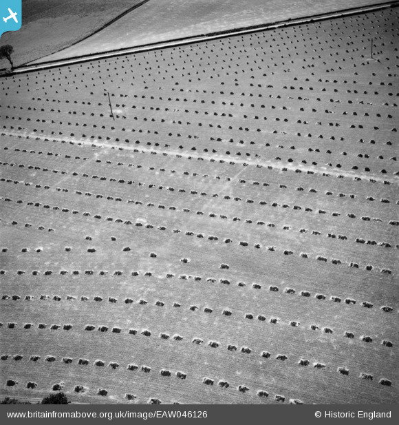
eaw046126 ENGLAND (1952). Fields in harvest near Rowley Cottage, Riplingham, 1952
© Copyright OpenStreetMap contributors and licensed by the OpenStreetMap Foundation. 2024. Cartography is licensed as CC BY-SA.
Details
| Title | [EAW046126] Fields in harvest near Rowley Cottage, Riplingham, 1952 |
| Reference | EAW046126 |
| Date | 22-August-1952 |
| Link | |
| Place name | RIPLINGHAM |
| Parish | ROWLEY |
| District | |
| Country | ENGLAND |
| Easting / Northing | 497349, 431713 |
| Longitude / Latitude | -0.52273174687661, 53.772427072453 |
| National Grid Reference | SE973317 |
Pins
User Comment Contributions
This is the field over the road from York Grounds Farm. With electric poles running across it. note the implied curved fence to the north east highlighted by the curved roll of sheaves |
 TomRobin |
Monday 11th of August 2014 11:44:37 AM |
Thank you TomRobin, we’ll update the catalogue with your location and post the new data here in due course. Yours, Katy Britain from Above Cataloguing Team Leader |
Katy Whitaker |
Monday 11th of August 2014 11:44:37 AM |


