
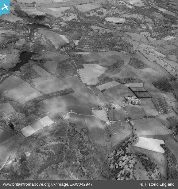
eaw042947 ENGLAND (1952). Countryside around Barlavington Farm including The Warren and Barlavington Hanger, Barlavington, 1952
© Copyright OpenStreetMap contributors and licensed by the OpenStreetMap Foundation. 2024. Cartography is licensed as CC BY-SA.
Nearby Images (8)
EAW042947

EAW042946

EAW042951

EAW042949

EAW042944

EAW042945

EAW042950

EAW042948

Details
| Title | [EAW042947] Countryside around Barlavington Farm including The Warren and Barlavington Hanger, Barlavington, 1952 |
| Reference | EAW042947 |
| Date | 5-July-1952 |
| Link | |
| Place name | BARLAVINGTON |
| Parish | BARLAVINGTON |
| District | |
| Country | ENGLAND |
| Easting / Northing | 497149, 116478 |
| Longitude / Latitude | -0.61716357033858, 50.939003473294 |
| National Grid Reference | SU971165 |
Pins
Be the first to add a comment to this image!


