
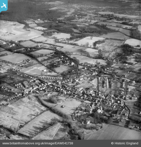
eaw041738 ENGLAND (1952). The village centre, Burnham, 1952
© Copyright OpenStreetMap contributors and licensed by the OpenStreetMap Foundation. 2024. Cartography is licensed as CC BY-SA.
Nearby Images (2)
EAW041738

EPW037502

Details
| Title | [EAW041738] The village centre, Burnham, 1952 |
| Reference | EAW041738 |
| Date | 20-February-1952 |
| Link | |
| Place name | BURNHAM |
| Parish | BURNHAM |
| District | |
| Country | ENGLAND |
| Easting / Northing | 493336, 182787 |
| Longitude / Latitude | -0.65413658961163, 51.535781801453 |
| National Grid Reference | SU933828 |
Pins
 designking |
Friday 19th of September 2014 10:52:12 PM | |
designking |
Friday 19th of September 2014 10:49:54 PM | |
designking |
Friday 19th of September 2014 10:49:23 PM | |
designking |
Friday 19th of September 2014 10:48:28 PM |


