
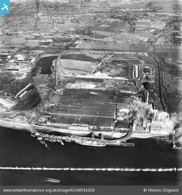
eaw041029 ENGLAND (1951). The Ford Motor Company Works, Dagenham, 1951. This image has been produced from a print marked by Aerofilms Ltd for photo editing.
© Copyright OpenStreetMap contributors and licensed by the OpenStreetMap Foundation. 2024. Cartography is licensed as CC BY-SA.
Nearby Images (48)
EAW041029

EPW061001

EPW060999

EAW029519

EAW029518

EPW046938

EAW029515

EAW029516

EAW022767

EAW029513

EPW062036

EPW061005

EPW055195

EAW029521

EAW029514

EPW055260

EAW000070

EPW055200

EAW041033

EAW022764

EAW053045

EPW061003

EPW061004

EAW053048

EAW000072

EAW022776

EPW055196

EPW055194

EPW062032

EPW055161

EPW055198

EAW000074

EPW061002

EPW055163

EAW029520

EAW053046

EAW022773

EAW029510

EPW055164

EPW046919

EPW055160

EAW029509

EAW022774

EPW055162

EPW009956

EPW046936

EPW046915

EPW032052

Details
| Title | [EAW041029] The Ford Motor Company Works, Dagenham, 1951. This image has been produced from a print marked by Aerofilms Ltd for photo editing. |
| Reference | EAW041029 |
| Date | 23-October-1951 |
| Link | |
| Place name | DAGENHAM |
| Parish | |
| District | |
| Country | ENGLAND |
| Easting / Northing | 549548, 181908 |
| Longitude / Latitude | 0.15554083704467, 51.515790746348 |
| National Grid Reference | TQ495819 |
Pins
 Billy Turner |
Tuesday 14th of July 2015 08:19:21 PM |


