
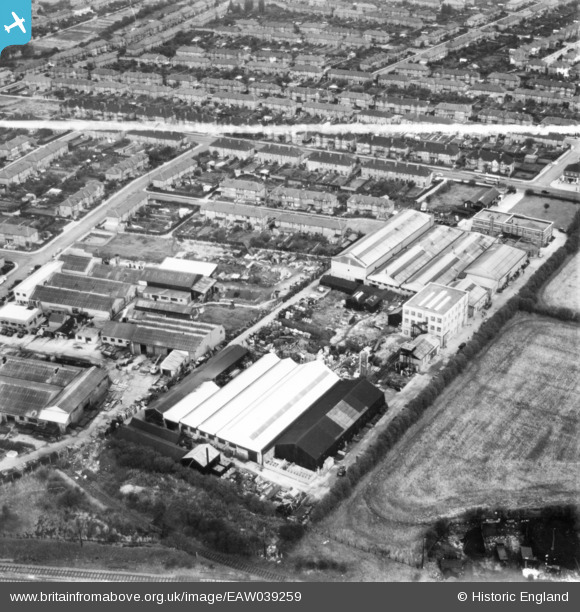
eaw039259 ENGLAND (1951). The Air Control Installation Works and surrounding residential area, South Ruislip, 1951. This image has been produced from a print marked by Aerofilms Ltd for photo editing.
© Copyright OpenStreetMap contributors and licensed by the OpenStreetMap Foundation. 2024. Cartography is licensed as CC BY-SA.
Nearby Images (10)
EAW039259

EAW039254

EAW039262

EAW039255

EAW039260

EAW039257

EAW039256

EAW039258

EAW039263

EAW039261

Details
| Title | [EAW039259] The Air Control Installation Works and surrounding residential area, South Ruislip, 1951. This image has been produced from a print marked by Aerofilms Ltd for photo editing. |
| Reference | EAW039259 |
| Date | 31-August-1951 |
| Link | |
| Place name | SOUTH RUISLIP |
| Parish | |
| District | |
| Country | ENGLAND |
| Easting / Northing | 510875, 185752 |
| Longitude / Latitude | -0.40039507209459, 51.55926112374 |
| National Grid Reference | TQ109858 |
Pins
Be the first to add a comment to this image!


