
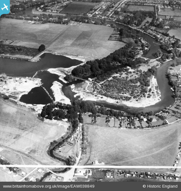
eaw038849 ENGLAND (1951). The Penton Hook Yacht Basin under construction alongside Penton Hook Island, Laleham, 1951. This image has been produced from a print marked by Aerofilms Ltd for photo editing.
© Copyright OpenStreetMap contributors and licensed by the OpenStreetMap Foundation. 2024. Cartography is licensed as CC BY-SA.
Nearby Images (10)
EAW038849

EAW038854

EAW038863

EAW038862

EAW038865

EAW038852

EAW038859

EAW038864

EAW038851

EAW003691

Details
| Title | [EAW038849] The Penton Hook Yacht Basin under construction alongside Penton Hook Island, Laleham, 1951. This image has been produced from a print marked by Aerofilms Ltd for photo editing. |
| Reference | EAW038849 |
| Date | 16-August-1951 |
| Link | |
| Place name | LALEHAM |
| Parish | |
| District | |
| Country | ENGLAND |
| Easting / Northing | 504219, 169089 |
| Longitude / Latitude | -0.5013047464163, 51.410739498538 |
| National Grid Reference | TQ042691 |
Pins
Be the first to add a comment to this image!


