
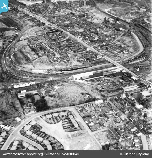
eaw038843 ENGLAND (1951). The Gasholder and Engineering Works off Dudley Road and environs, Brockmoor, 1951. This image has been produced from a print.
© Copyright OpenStreetMap contributors and licensed by the OpenStreetMap Foundation. 2024. Cartography is licensed as CC BY-SA.
Nearby Images (3)
EAW038843

EAW038844

EAW038842

Details
| Title | [EAW038843] The Gasholder and Engineering Works off Dudley Road and environs, Brockmoor, 1951. This image has been produced from a print. |
| Reference | EAW038843 |
| Date | 15-August-1951 |
| Link | |
| Place name | BROCKMOOR |
| Parish | |
| District | |
| Country | ENGLAND |
| Easting / Northing | 391954, 288099 |
| Longitude / Latitude | -2.1185128960586, 52.490377115287 |
| National Grid Reference | SO920881 |
Pins
 black country history hunter |
Friday 18th of September 2015 04:59:42 PM | |
also their mining operations on this site in earlier times |
black country history hunter |
Friday 18th of September 2015 05:01:01 PM |


