
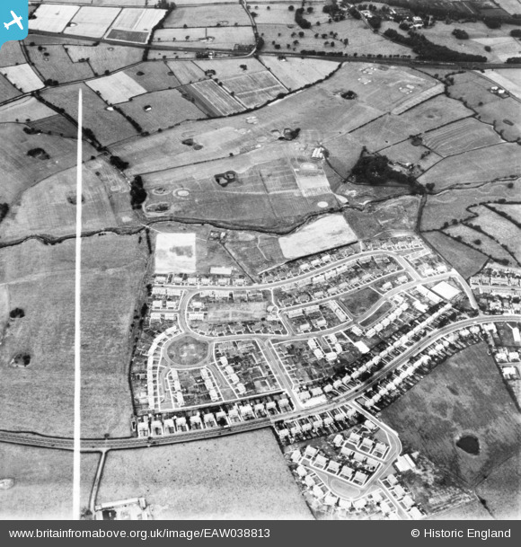
eaw038813 ENGLAND (1951). Housing development off Blackpool Road, Lea, 1951. This image has been produced from a print marked by Aerofilms Ltd for photo editing.
© Copyright OpenStreetMap contributors and licensed by the OpenStreetMap Foundation. 2024. Cartography is licensed as CC BY-SA.
Nearby Images (6)
EAW038813

EAW038818

EAW038819

EAW038814

EAW038817

EAW038815

Details
| Title | [EAW038813] Housing development off Blackpool Road, Lea, 1951. This image has been produced from a print marked by Aerofilms Ltd for photo editing. |
| Reference | EAW038813 |
| Date | 15-August-1951 |
| Link | |
| Place name | LEA |
| Parish | LEA |
| District | |
| Country | ENGLAND |
| Easting / Northing | 349170, 430458 |
| Longitude / Latitude | -2.771239644663, 53.767766285733 |
| National Grid Reference | SD492305 |


