
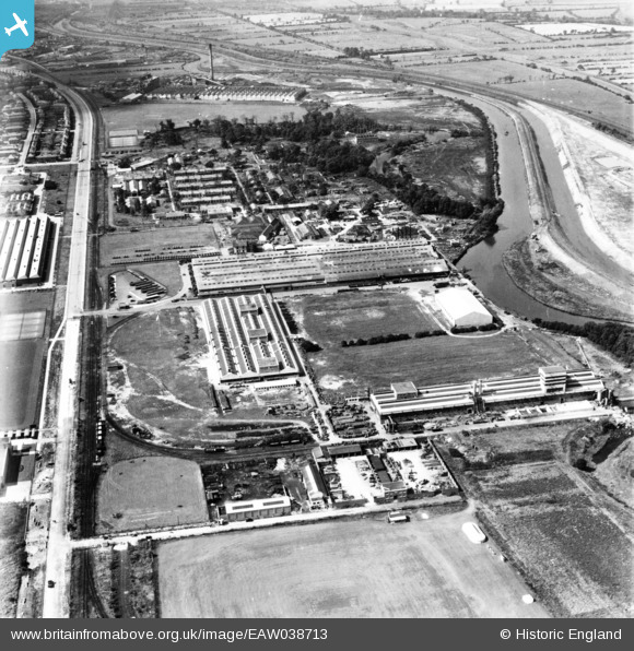
eaw038713 ENGLAND (1951). The International Harvester Factory off Wheatley Hall Road and environs, Doncaster, 1951. This image has been produced from a print.
© Copyright OpenStreetMap contributors and licensed by the OpenStreetMap Foundation. 2024. Cartography is licensed as CC BY-SA.
Nearby Images (19)
EAW038713

EAW038718

EAW027263

EAW038716

EAW038708

EAW038717

EAW027261

EAW038709

EAW027268

EAW038710

EAW027266

EAW038714

EAW027262

EAW038712

EAW027264

EAW027260

EAW027267

EAW038711

EAW038715

Details
| Title | [EAW038713] The International Harvester Factory off Wheatley Hall Road and environs, Doncaster, 1951. This image has been produced from a print. |
| Reference | EAW038713 |
| Date | 14-August-1951 |
| Link | |
| Place name | DONCASTER |
| Parish | |
| District | |
| Country | ENGLAND |
| Easting / Northing | 459374, 405603 |
| Longitude / Latitude | -1.1038897552659, 53.543462577142 |
| National Grid Reference | SE594056 |
Pins
 redmist |
Tuesday 10th of May 2022 10:14:03 PM |


