
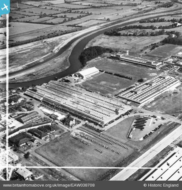
eaw038708 ENGLAND (1951). The International Harvester Factory off Wheatley Hall Road, Doncaster, 1951. This image has been produced from a print marked by Aerofilms Ltd for photo editing.
© Copyright OpenStreetMap contributors and licensed by the OpenStreetMap Foundation. 2024. Cartography is licensed as CC BY-SA.
Nearby Images (19)
EAW038708

EAW038709

EAW038717

EAW027261

EAW027263

EAW038714

EAW038713

EAW027266

EAW038718

EAW027262

EAW038716

EAW027268

EAW027260

EAW038710

EAW027264

EAW027267

EAW038712

EAW038711

EAW038715

Details
| Title | [EAW038708] The International Harvester Factory off Wheatley Hall Road, Doncaster, 1951. This image has been produced from a print marked by Aerofilms Ltd for photo editing. |
| Reference | EAW038708 |
| Date | 14-August-1951 |
| Link | |
| Place name | DONCASTER |
| Parish | |
| District | |
| Country | ENGLAND |
| Easting / Northing | 459317, 405643 |
| Longitude / Latitude | -1.104742333508, 53.543828551337 |
| National Grid Reference | SE593056 |


