
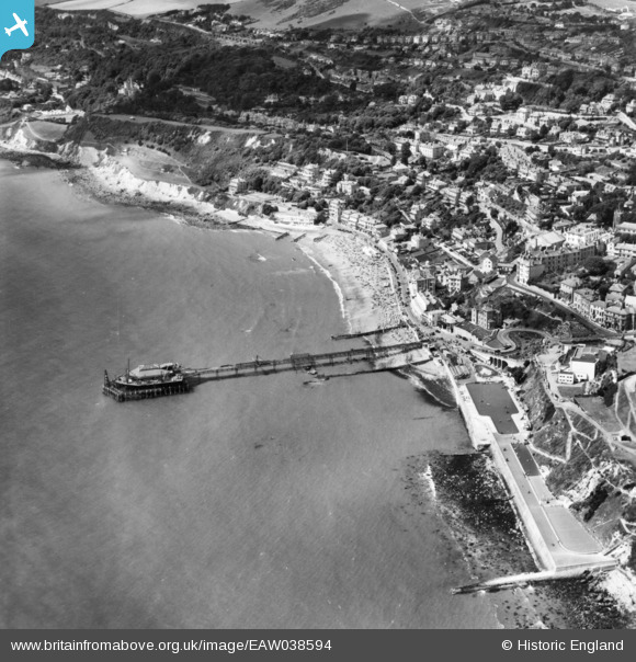
eaw038594 ENGLAND (1951). Mill Cove, Royal Victoria Pier and Ventnor Bay, Ventnor, 1951. This image has been produced from a print.
© Copyright OpenStreetMap contributors and licensed by the OpenStreetMap Foundation. 2024. Cartography is licensed as CC BY-SA.
Nearby Images (27)
EAW038594

EAW015243

EPW039656

EAW038592

EAW022209

EPW043010

EPW023099

EPW022979

EPW032286

EAW015242

EPW039654

EPW023097

EAW022207

EPW023096

EAW022210

EPW039653

EPW022977

EAW022208

EPW032285

EPW043014

EPW032288

EPW023098

EAW038593

EPW043013

EPW032287

EPW022982

EPW000505

Details
| Title | [EAW038594] Mill Cove, Royal Victoria Pier and Ventnor Bay, Ventnor, 1951. This image has been produced from a print. |
| Reference | EAW038594 |
| Date | 13-August-1951 |
| Link | |
| Place name | VENTNOR |
| Parish | VENTNOR |
| District | |
| Country | ENGLAND |
| Easting / Northing | 456253, 77288 |
| Longitude / Latitude | -1.2051961466781, 50.592019065383 |
| National Grid Reference | SZ563773 |
Pins
Be the first to add a comment to this image!


