
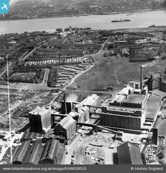
eaw038515 ENGLAND (1951). Buchanan's Flour Mill, the Homepride Flour Mills and environs, Seacombe, 1951. This image has been produced from a print marked by Aerofilms Ltd for photo editing.
© Copyright OpenStreetMap contributors and licensed by the OpenStreetMap Foundation. 2024. Cartography is licensed as CC BY-SA.
Nearby Images (29)
EAW038515

EAW036043

EAW036041

EAW038512

EAW038518

EAW036042

EAW038519

EAW038513

EAW036040

EAW051423

EAW038514

EAW036046

EAW036038

EAW036039

EAW036045

EAW038510

EAW036047

EAW038511

EAW036044

EAW038516

EAW038509

EPW026317

EPW026316

EPW026320

EPW026319

EPW026314

EPW026318

EPW026315

EPW026313

Details
| Title | [EAW038515] Buchanan's Flour Mill, the Homepride Flour Mills and environs, Seacombe, 1951. This image has been produced from a print marked by Aerofilms Ltd for photo editing. |
| Reference | EAW038515 |
| Date | 1-August-1951 |
| Link | |
| Place name | SEACOMBE |
| Parish | |
| District | |
| Country | ENGLAND |
| Easting / Northing | 331714, 390479 |
| Longitude / Latitude | -3.0273049384922, 53.4064439714 |
| National Grid Reference | SJ317905 |
Pins
Be the first to add a comment to this image!


