
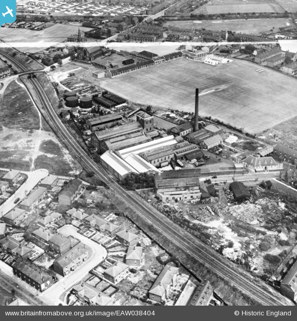
eaw038404 ENGLAND (1951). Fletcher Miller Ltd Alma Mills and environs, Flowery Field, 1951. This image has been produced from a print marked by Aerofilms Ltd for photo editing.
© Copyright OpenStreetMap contributors and licensed by the OpenStreetMap Foundation. 2024. Cartography is licensed as CC BY-SA.
Nearby Images (16)
EAW038404

EAW038405

EAW038409

EAW038412

EAW038402

EAW038411

EAW038401

EAW038444

EAW038403

EAW038406

EAW038408

EAW038407

EAW038410

EAW050225

EAW050222

EAW050221

Details
| Title | [EAW038404] Fletcher Miller Ltd Alma Mills and environs, Flowery Field, 1951. This image has been produced from a print marked by Aerofilms Ltd for photo editing. |
| Reference | EAW038404 |
| Date | 2-August-1951 |
| Link | |
| Place name | FLOWERY FIELD |
| Parish | |
| District | |
| Country | ENGLAND |
| Easting / Northing | 394385, 395799 |
| Longitude / Latitude | -2.0845752060412, 53.458657172069 |
| National Grid Reference | SJ944958 |
Pins
Be the first to add a comment to this image!


