
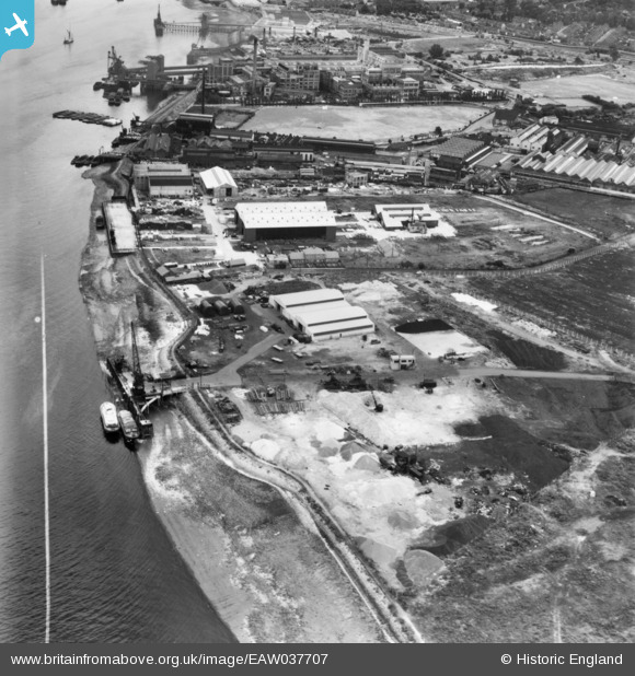
eaw037707 ENGLAND (1951). Mulberry Wharf near Jenningtree Point and environs, Erith, 1951. This image has been produced from a print marked by Aerofilms Ltd for photo editing.
© Copyright OpenStreetMap contributors and licensed by the OpenStreetMap Foundation. 2024. Cartography is licensed as CC BY-SA.
Nearby Images (22)
EAW037707

EAW037705

EAW037704

EAW037708

EAW037702

EAW037703

EAW037706

EAW020307

EAW020318

EAW020317

EAW020314

EAW037701

EAW020315

EAW020316

EAW020313

EAW020306

EAW020308A

EAW020312

EAW020311

EAW020308

EAW020309

EAW020310

Details
| Title | [EAW037707] Mulberry Wharf near Jenningtree Point and environs, Erith, 1951. This image has been produced from a print marked by Aerofilms Ltd for photo editing. |
| Reference | EAW037707 |
| Date | 12-July-1951 |
| Link | |
| Place name | ERITH |
| Parish | |
| District | |
| Country | ENGLAND |
| Easting / Northing | 550640, 180079 |
| Longitude / Latitude | 0.17048707271921, 51.499065117056 |
| National Grid Reference | TQ506801 |
Pins
Be the first to add a comment to this image!


