
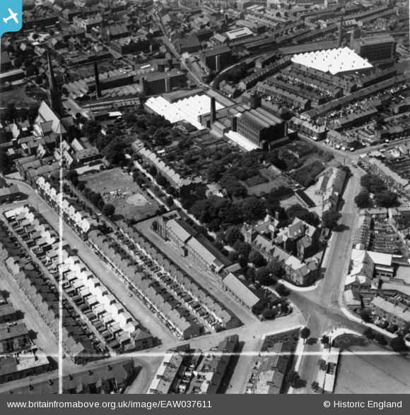
eaw037611 ENGLAND (1951). The Royal Grammar School, Greenfield Cotton Mill and environs, Lancaster, 1951. This image has been produced from a print marked by Aerofilms Ltd for photo editing.
© Copyright OpenStreetMap contributors and licensed by the OpenStreetMap Foundation. 2024. Cartography is licensed as CC BY-SA.
Nearby Images (8)
EAW037611

EAW037612

EAW037609

EAW037608

EAW037610

EAW037607

EPW002088

EPW042036

Details
| Title | [EAW037611] The Royal Grammar School, Greenfield Cotton Mill and environs, Lancaster, 1951. This image has been produced from a print marked by Aerofilms Ltd for photo editing. |
| Reference | EAW037611 |
| Date | 30-June-1951 |
| Link | |
| Place name | LANCASTER |
| Parish | |
| District | |
| Country | ENGLAND |
| Easting / Northing | 348286, 461537 |
| Longitude / Latitude | -2.7899042346616, 54.047017299547 |
| National Grid Reference | SD483615 |
Pins
Be the first to add a comment to this image!


