
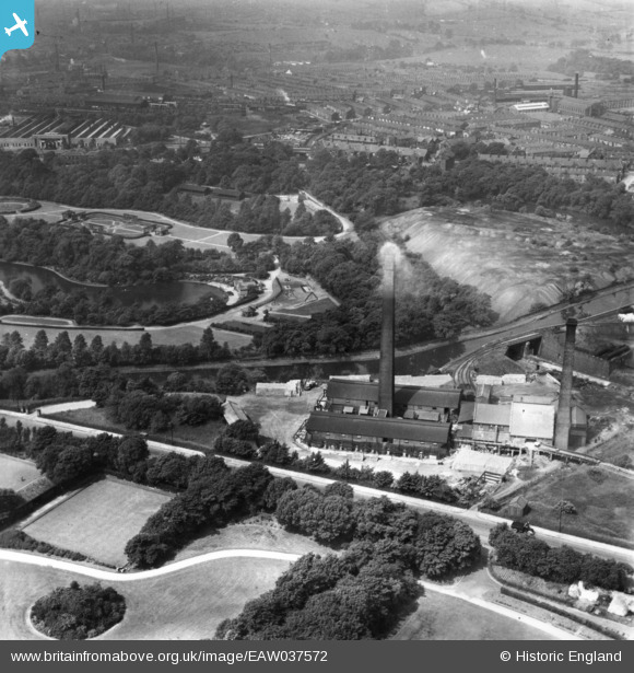
eaw037572 ENGLAND (1951). The Burnley Brick and Lime Co Works, Burnley, 1951. This image has been produced from a print.
© Copyright OpenStreetMap contributors and licensed by the OpenStreetMap Foundation. 2024. Cartography is licensed as CC BY-SA.
Nearby Images (8)
EAW037572

EAW037571

EAW037569

EAW037573

EAW037570

EPW030012

EPW030030

EPW030008

Details
| Title | [EAW037572] The Burnley Brick and Lime Co Works, Burnley, 1951. This image has been produced from a print. |
| Reference | EAW037572 |
| Date | 30-June-1951 |
| Link | |
| Place name | BURNLEY |
| Parish | |
| District | |
| Country | ENGLAND |
| Easting / Northing | 384608, 433364 |
| Longitude / Latitude | -2.2336973027756, 53.796141326017 |
| National Grid Reference | SD846334 |
Pins
Be the first to add a comment to this image!


