
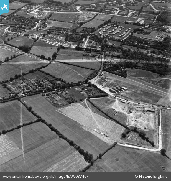
eaw037464 ENGLAND (1951). Factory buildings under construction off Maylands Avenue, Wood Lane End and environs, Adeyfield, 1951. This image has been produced from a print marked by Aerofilms Ltd for photo editing.
© Copyright OpenStreetMap contributors and licensed by the OpenStreetMap Foundation. 2024. Cartography is licensed as CC BY-SA.
Nearby Images (25)
EAW037464

EAW037469

EAW048148

EAW037465

EAW042002

EAW048145

EAW042004

EAW037466

EAW042003

EAW048146

EAW048139

EAW042001

EAW048149

EAW048144

EAW048150

EAW041999

EAW048142

EAW042013

EAW042000

EAW048140

EAW048143

EAW048141

EAW048147

EAW042010

EAW042015

Details
| Title | [EAW037464] Factory buildings under construction off Maylands Avenue, Wood Lane End and environs, Adeyfield, 1951. This image has been produced from a print marked by Aerofilms Ltd for photo editing. |
| Reference | EAW037464 |
| Date | 2-July-1951 |
| Link | |
| Place name | ADEYFIELD |
| Parish | |
| District | |
| Country | ENGLAND |
| Easting / Northing | 507895, 208016 |
| Longitude / Latitude | -0.43649662639116, 51.759968592563 |
| National Grid Reference | TL079080 |
Pins
Be the first to add a comment to this image!


